
Le Pouce by bus
Le Pouce is one of the few Mauritian mountains you can reach by bus from either side. NTC routes 153 and 167 end at the Saint-Pierre traffic centre below the Petit Verger start, and the northern trailhead sits in Tranquebar, a suburb of Port Louis with its own bus stops. That makes a through-hike possible, up from Saint-Pierre and down into the capital, with a bus at each end.
Read the guide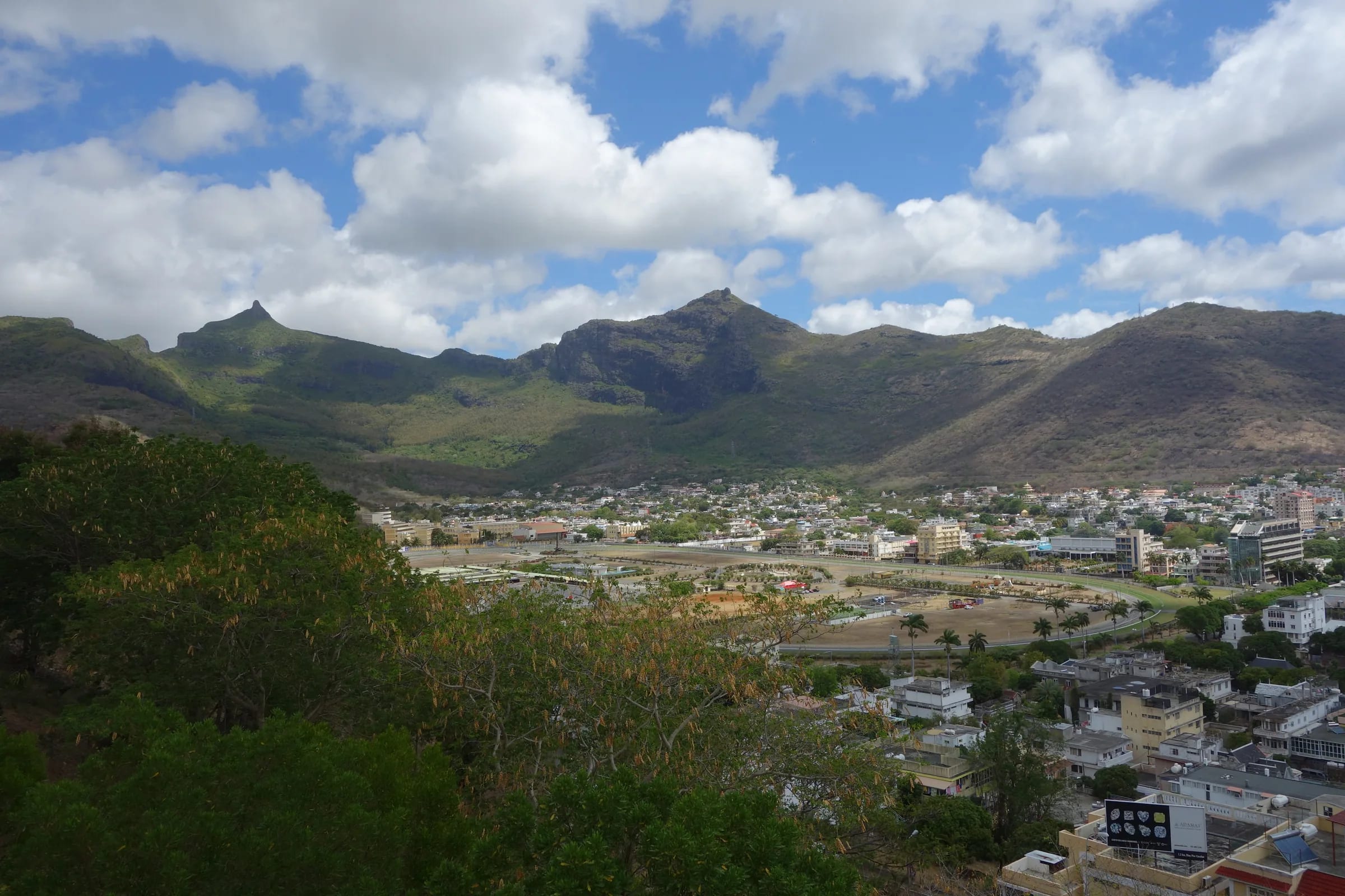
Two trailheads, two different bus problems
The standard route starts at Petit Verger, a small car park at 381 m at the end of a farm lane above Saint-Pierre, on the Moka side of the mountain. The northern route starts where Chateau D’Eau Street ends in Tranquebar, on the Port Louis side. Buses serve both, but not in the same way. Saint-Pierre is a rural traffic centre at the end of two NTC routes from the plateau towns, with a walk up to the trailhead afterwards. Tranquebar is a city suburb a kilometre or so above the Champ de Mars, served by local Port Louis buses and reachable on foot from the centre.
Mauritian buses are cheap, frequent on the main corridors and run by several operators, including the blue NTC buses, UBS, Rose-Hill Transport, Triolet Bus Service and many individual operators. Port Louis has two terminals. Victoria Square serves the south and the centre of the island, which is the direction of Moka and Saint-Pierre, and Immigration Square serves the north. A shuttle links the two and it is also an easy walk.
Reaching Saint-Pierre for the Petit Verger start
Two NTC routes terminate at the Saint-Pierre traffic centre. Route 153 runs from Curepipe through Floréal, Vacoas, Quatre Bornes, Ebène, Réduit, the Mahatma Gandhi Institute and Gentilly. Route 167 runs from Bord Cascades and Henrietta through Ebène, Réduit, the Mahatma Gandhi Institute, Moka and Gentilly. Both pass Réduit, which is the point where the Metro Express branch meets them.
From Port Louis the picture is less certain. An undated timetable lists an individual-operator route 12, with a 12A variant, from Victoria Square through Mount Ory, Moka and the Bois Chéri Road to the Saint-Pierre traffic centre and on to Quartier Militaire. This guide has not been able to verify it against a current schedule. The reliable method is to ask at Victoria Square for a bus to Saint-Pierre or Quartier Militaire through Moka, and to check the destination board before boarding.
The Metro Express runs from Port Louis through Rose Hill, Quatre Bornes and Vacoas to Curepipe, with a branch from Rose Hill to Ebène and Réduit. For a hiker it is the fast way out of the capital or the plateau towns to the point where the 153 and 167 pass. Bus listings name stops at the Réduit roundabout and at the University of Mauritius, so check on a map how the metro stop and the bus stops sit relative to each other before you rely on the change.
| From | Route | To | Notes |
|---|---|---|---|
| Curepipe | NTC 153 | Saint-Pierre traffic centre | Via Floréal, Vacoas, Quatre Bornes, Ebène, Réduit, MGI and Gentilly |
| Bord Cascades and Henrietta | NTC 167 | Saint-Pierre traffic centre | Via Ebène, Réduit, MGI, Moka and Gentilly |
| Port Louis, Victoria Square | Route 12 or 12A, individual operator | Saint-Pierre traffic centre, then Quartier Militaire | Via Mount Ory, Moka and Bois Chéri Road. Undated timetable, unverified |
| Port Louis or Curepipe | Metro Express, branch from Rose Hill | Ebène and Réduit | Change to 153 or 167 near Réduit. Rs 35 to 55 single |
From the traffic centre up to the trailhead
The Saint-Pierre traffic centre is in the village, and the car park is above it at 381 m, so the last leg is on foot and uphill. The lane to the trailhead leaves the Bois Chéri Road at a sharp bend between Moka and Saint-Pierre, past a mosque, and is marked by a small brown Le Pouce sign before it runs through cane to the parking area. It is a steady uphill walk of some minutes rather than a hike in itself, but this guide has not measured it and will not guess, so load the car park position, about 20.2077 S and 57.5271 E, into an offline map and check the distance from where your bus stops.
Bus listings also show a stop named Moka (Junction Leclezio and Bois Chéri Road). Depending on where exactly your bus runs, that junction may be nearer the lane than the traffic centre is. Compare the two on the map before you decide where to get off, and if in doubt ask the conductor for the stop nearest the Le Pouce turning. Buses on this road are a daily fact of life for people who live along it, and a hiker with a map is not an unusual sight.
Tranquebar and Vallée des Prêtres on the Port Louis side
The northern trailhead is where Chateau D’Eau Street ends in Tranquebar. A published loop from the Champ de Mars racecourse follows rue Château d’Eau and reaches the Le Dauguet sports ground, with its parking and oratory, after about a kilometre. The mountain path continues from there past a Hindu temple to a signposted junction where the Le Pouce trail turns left and steepens. Bus listings name a stop at Tranquebar (Cité Madelaine), served by local city buses. This guide has not identified the route numbers, so ask at Victoria Square or simply walk from the centre. From the racecourse it is an uphill stroll through ordinary streets.
Vallée des Prêtres, the next valley to the north-east, has a bus terminus and is named as another way up the mountain, but no route description has been published and this guide has not walked it. Treat it as a stop name, not a trailhead, unless you are with someone who knows the way.
The Port Louis side has had robberies of hikers on the Le Dauguet approach, in November 2022 and again in October 2025. Go early, in company, with phones and cash out of sight, and read the safety page before you set off from this side.
The through-hike from Saint-Pierre to Port Louis
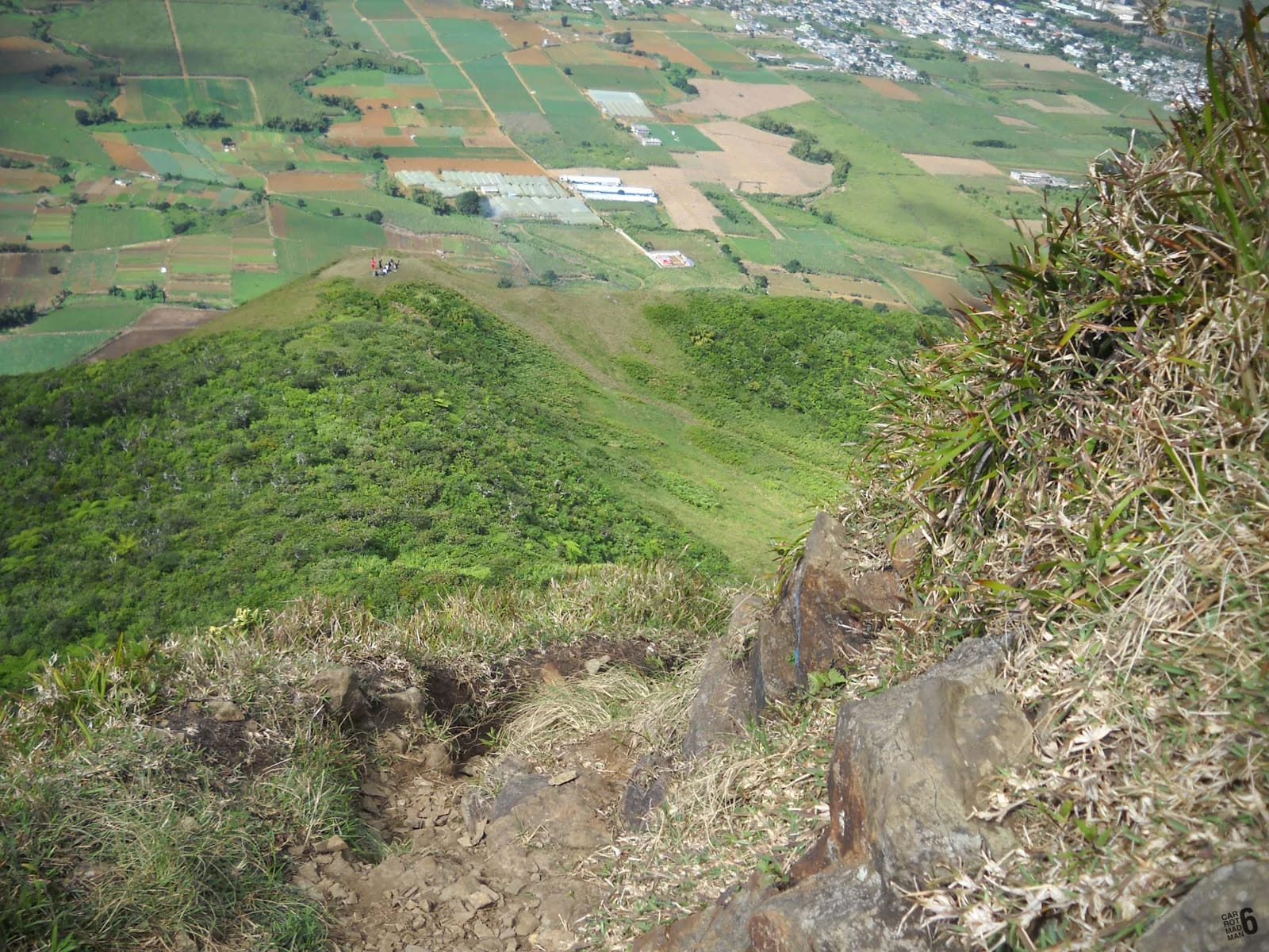
Buses at both ends make a traverse practical, and it is the best thing the public transport network offers a Le Pouce hiker. Take the 153 or 167 to Saint-Pierre, or any bus through Moka, walk up to the Petit Verger car park, climb the standard route to the summit, and come back down to the shoulder. Roughly halfway down the Petit Verger track a path branches off towards Port Louis and descends north-west through forest to Tranquebar, marked by blue and white painted stones every few hundred metres. In the city, walk or take a local bus to the centre, then a bus home from Victoria Square or Immigration Square.
The distance is about 6 km from Saint-Pierre to Tranquebar, with roughly 390 m of climbing and about 690 m of descent. The northern path is longer, shadier and stonier than the Moka side, with mosquitoes in the lower forest. Route descriptions written for the ascent say to stay left at forks on the main trail and to avoid a significant left fork that crosses a stream. Coming down, left and right swap, so carry the GPX from the map page and check it at every junction. Allow most of a morning, and start on an early bus so the rural leg is behind you before the heat.
Doing it the other way round, up from Tranquebar and down to Saint-Pierre, is harder and ends with a rural bus. Rural services run to about 18:30, so if you choose that direction, be down at the traffic centre with time in hand.
Fares, hours and how the system works
Bus fares are set by distance. The published range is Rs 17 for a short hop to Rs 47 for a long trip, according to the official tariff of 8 May 2022, so expect current fares to be a little higher and carry small notes and coins. You pay the conductor on board. Express buses with air conditioning cost extra, and a large rucksack may mean paying for a second seat. Metro Express singles run from Rs 35 to Rs 55 depending on the stations and are bought separately.
Buses run from about 05:30 to 20:00 in the towns and from about 06:30 to 18:30 in the countryside, which is where Saint-Pierre sits. There is no reliable published last-bus time for the Saint-Pierre routes, so treat 18:30 as the end of the day on that side and aim to be at the traffic centre well before it. Expect thinner services on Sundays and public holidays. Timetables published online are described by their own compilers as estimates without warranty, and the sensible habit is to confirm the return at the terminus before you walk up.
- Start on the first bus you can. The whole point of the bus day is to be on the mountain before the heat.
- Carry the GPX for both routes, since a bus hiker has no car to return to and cannot afford a wrong turn.
- Keep the fare money separate from your valuables, and keep phones out of sight at the Port Louis end.
- If you are not confident about the Saint-Pierre return, finish in Port Louis instead, where the city buses run later.
Questions people ask
Which bus goes to Le Pouce?
No bus goes to the trailhead itself. For the standard Petit Verger start, take NTC route 153 from Curepipe or route 167 from Henrietta to the Saint-Pierre traffic centre and walk uphill to the car park. From Port Louis, local buses serve Tranquebar (Cité Madelaine) for the northern route, and that trailhead is also walkable from the centre of the city.
Is there a bus from Port Louis to Saint-Pierre?
An undated timetable lists an individual-operator route 12, with a 12A variant, from Victoria Square through Mount Ory, Moka and the Bois Chéri Road to the Saint-Pierre traffic centre and Quartier Militaire. This guide has not verified it. Ask at Victoria Square for a bus to Saint-Pierre or Quartier Militaire via Moka, or take the Metro Express to Réduit and change to route 153 or 167.
Can I take the Metro Express to Le Pouce?
Not all the way. The Metro Express runs from Port Louis through Rose Hill, Quatre Bornes and Vacoas to Curepipe, with a branch from Rose Hill to Ebène and Réduit. Réduit is on both NTC routes to Saint-Pierre, so the metro gets you to the change point. Singles cost Rs 35 to 55. Check how the metro stop and the Réduit bus stops sit relative to each other before you rely on it.
How much does the bus cost?
Between Rs 17 and Rs 47 a trip under the official tariff of 8 May 2022, depending on distance. Fares may have risen since, so carry small change and ask the conductor. Air-conditioned express services cost more, and the Metro Express has its own fares of Rs 35 to 55 for a single. Tickets are bought on board the bus and separately for the metro.
What time is the last bus back from Saint-Pierre?
This guide could not find a reliable published time. Rural services in Mauritius run to about 18:30, and Saint-Pierre counts as rural, so plan to be at the traffic centre well before then, and confirm the last departure with a conductor or at the terminus before you walk up. If you are running late, finishing in Port Louis instead gives you city buses that run until about 20:00.
Can I hike over the mountain and take a bus back?
Yes, and it is the best bus day on Le Pouce. Go up from Saint-Pierre on the standard route, down the northern path to Tranquebar, then walk or take a bus into central Port Louis and a bus home from Victoria Square or Immigration Square. It is about 6 km with roughly 390 m up and 690 m down. Carry the GPX, since the junctions are not obvious on the descent.
Walking across the mountain?
The Port Louis route page describes the northern path stage by stage, including the junctions that matter on the descent.