
Moka and Saint-Pierre, the quiet side of Le Pouce
Most people climb Le Pouce from the Moka side, and most see nothing of Moka except the cane road to the car park. That is a pity, because the district holds the President’s residence at Le Réduit, the university, the island’s largest mall for last-minute supplies and, in Saint-Pierre, an ordinary Mauritian village with a market and a bus station a few minutes below the trailhead. This page explains how the pieces fit together.
Read the guide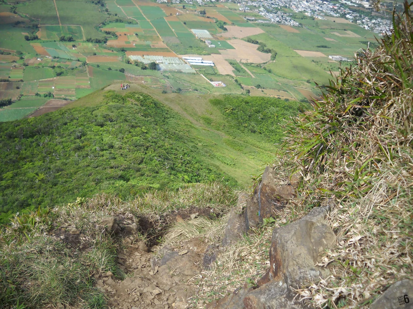
Where Moka sits in relation to the mountain
Moka is the village directly on the other side of the Moka Range from Port Louis. The capital sits at sea level on the dry northern face. Moka sits on the plateau side at about 200 m, with parts of the district above 400 m, and the difference shows in the climate. The village has a tropical wet climate, warmest in February at around 28 °C and coolest on August nights at around 15 °C, with October the driest month and February the wettest. Expect the cane to be green and the air a few degrees cooler than the city.
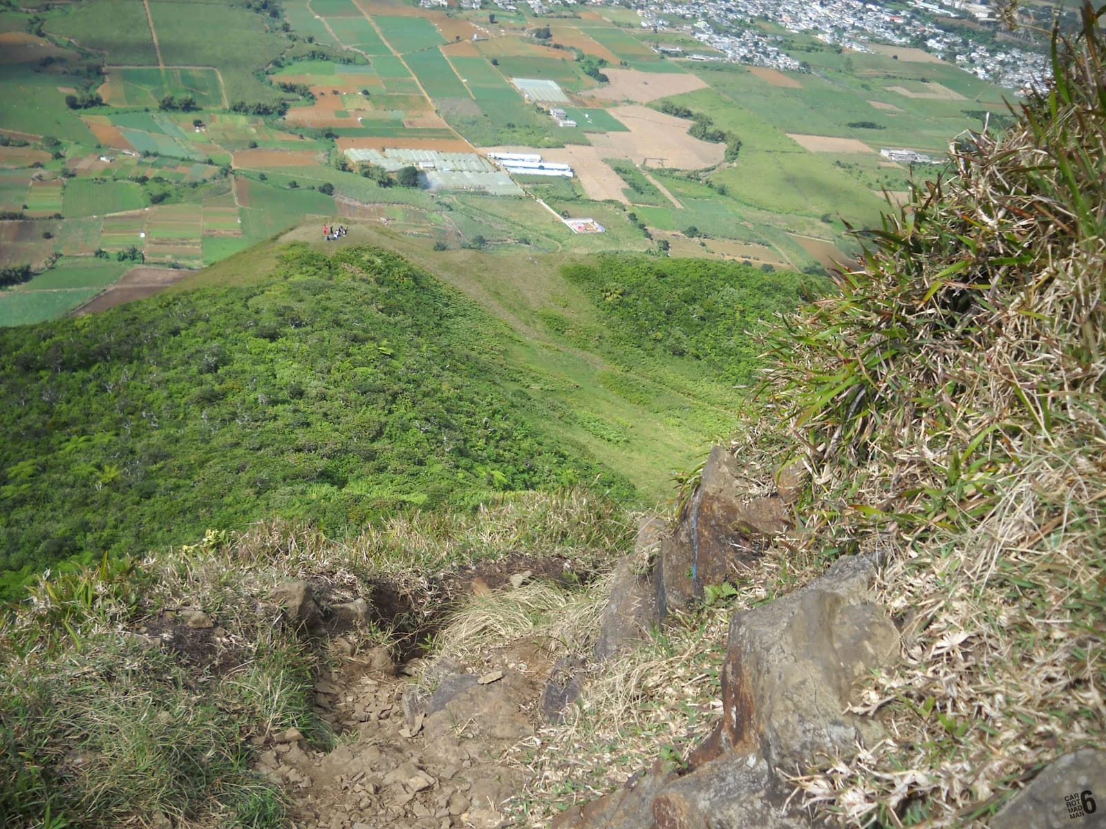
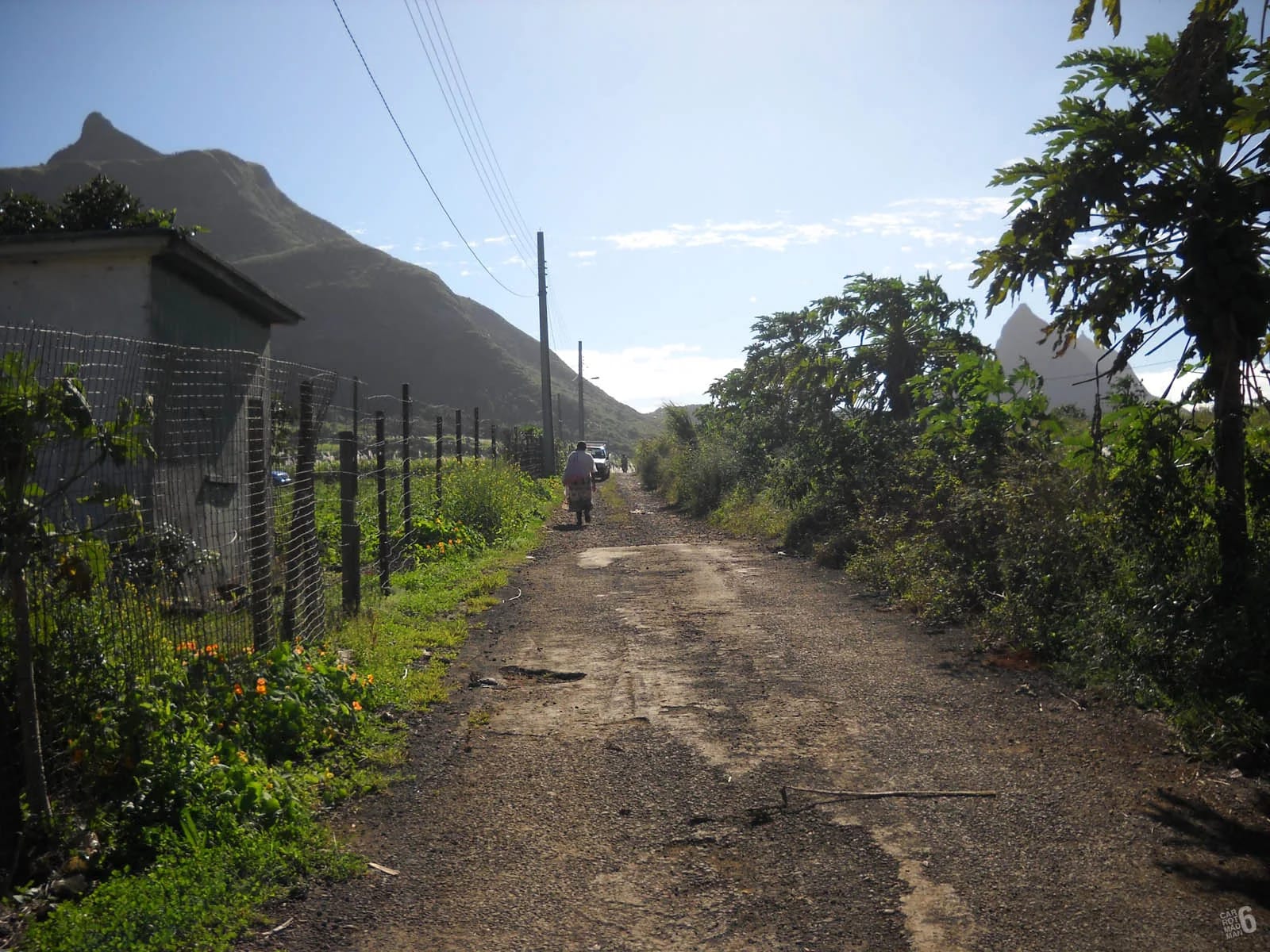
Moka village itself had 8,846 residents at the 2011 census, but the name covers a wider district that takes in Réduit, Mount Ory, Saint-Pierre and the slopes of Le Pouce, whose nearest village is La Laura-Malenga. Between the houses and the mountain lies a belt of sugar cane crossed by farm roads, and it is through this cane that the road to the Petit Verger trailhead climbs. From the plateau the thumb reads as a clean point on the ridge. The famous profile that gives the mountain its name belongs to the Port Louis side.
Le Réduit and the university quarter
Le Réduit, in the Réduit suburb of Moka, is the official residence of the President of Mauritius. Governor Barthélemy David began a fortified residence here in 1748, completed in 1749, as a refuge in case of attack. The present château dates from a rebuilding completed in 1778 under Governor La Brillane, whose date is carved over the main door. The estate covers about 97 hectares on a triangle of land between the gorges of two rivers, the Profonde and the Cascade, and a small memorial, the Temple de l’Amour, was added in 1921.
The grounds are not open to casual visitors. The château has traditionally opened to the public on two days a year, in October and March, and outside those days you see the gates and the avenue only, which is why the things-to-do page lists it as an external stop. Next door is the University of Mauritius, established by ordinance in December 1965, with around 12,000 students in the mid-2010s, alongside the Mahatma Gandhi Institute and the national broadcaster. The result is a student quarter with cafés and simple lunch places that most visitors never find, served by the Metro Express branch from Rose Hill to Ebène and Réduit.
Bagatelle for supplies and food
Bagatelle Mall of Mauritius, on the Réduit side of Moka, opened in 2011, developed by ENL Property with South Africa’s Atterbury group. The first phase covers 42,000 square metres with more than 140 shops, a food court, restaurants, cinemas and a hotel, and a 9,000 square metre extension opened in 2015. It is about 3.6 km from the Petit Verger car park in a straight line, roughly ten minutes by car, and it is the easiest place in the area to buy water, fruit, sun cream, a hat or anything you forgot before a hike, or to find a proper meal afterwards.
Two practical notes. Mall hours begin well after dawn, so buy water the evening before if you are climbing at first light, and check current opening times rather than assuming them. And it is a mall, not a sight. Go for what you need and give the rest of the day to the mountain, Eureka and the village.
Saint-Pierre village and the B47 approach
Saint-Pierre is a village in Moka District with a market, the Kendra shopping centre, a church, a mosque, banks and schools. It had a railway station until the line closed in the 1960s, and its bus station, the traffic centre, is within walking distance of the market. It is the last place to buy a drink or a snack before the trail, and the base for anyone arriving by bus.
The approach by car is simple once you know it, and poorly signposted until you do. Local reports describe around fifteen small signs between the main road and the summit, but the first turn is the one people miss.
From the motorway
Leave the motorway at the Mount Ory and Moka exit, pass Eureka House and join the B47, the Bois Chéri Road, heading for Saint-Pierre.
On the B47
Watch for a mosque and, just after it, a sharp right-hand bend. A small paved farm road leaves the bend and heads into the cane, marked by a brown Le Pouce sign that is easy to miss.
Through the cane
Follow the farm road uphill to a small car park for four or five cars at about 381 m, with more space on the verge. At weekends it fills early, so arrive early or expect to park lower down and walk.
On foot from Saint-Pierre
From the traffic centre the car park is about 2 km away in a straight line and uphill all the way on quiet cane roads, so allow 30 to 45 minutes.
How the trailhead sits above the village
The car park is already high. At 381 m it stands roughly 180 m above Moka village and well above the centre of Saint-Pierre, which is about 2 km away in a straight line. That is why the climb from Petit Verger is the shorter one. Our mapped route from the car park to the 812 m summit is 2.05 km one way with about 390 m of ascent, against 3.6 km and about 690 m from Tranquebar on the Port Louis side. The first half hour follows the farm track past a large kiosk at about 437 m, then switchbacks through forest to the grassy shoulder at about 620 to 625 m, with the steep final spur above.
There is no fee, no gate and no guide requirement on this side, only a wooden sign listing the routes and, as reported in 2023, Safe City cameras at the entrance. Blue and white paint marks on posts and trees show the way. Published figures for the round trip vary from 3.7 to 4.6 km, 320 to 410 m of ascent and 1 h 45 to 3 h, depending on where each walker started measuring and how long they sat on top. Drive times in the table are rough estimates for a quiet road, so check a map app on the day.
| Place | Straight line | Rough drive |
|---|---|---|
| Saint-Pierre traffic centre | About 2 km | 5 minutes |
| Eureka House | About 3.3 km | 10 minutes |
| Bagatelle Mall | About 3.6 km | 10 minutes |
| Le Réduit gates | About 4.8 km | 15 minutes |
| Port Louis, Central Market | About 5.8 km | 20 to 25 minutes |
| Tranquebar trailhead | About 3.4 km | About 6 km on foot over the mountain |
What the quiet side offers after the hike
The Moka side is where to eat and rest if you want to avoid the heat of the capital. Saint-Pierre has its market, the Réduit quarter has its student cafés, Bagatelle has everything under one roof, and Eureka House, ten minutes away, has served Creole lunches and tea on its veranda for years, though you should confirm what is on offer before counting on it. The cane roads around the trailhead are working farm roads, so park tight, leave gates as you found them and never block the track.
If you have a second morning, the same side of the range gives the easiest look at Pieter Both, whose balanced boulder shows above the ridge from the meadows on the Le Pouce trail. It is also the natural base for the things-to-do list on this site, all of which lies within a short drive of the car park.
Questions people ask
Is Moka a good base for climbing Le Pouce?
Yes, it is the closest one. The Petit Verger car park is about ten minutes’ drive from Eureka and Bagatelle and about 20 to 25 minutes from the centre of Port Louis, so a Moka base lets you start at first light without a long drive. Accommodation is limited compared with the coast, and the where-to-stay page sets out the trade-offs honestly.
Where exactly do I park for Le Pouce on the Moka side?
At the end of the small farm road that leaves the B47 at a sharp bend just after the mosque, marked by a brown Le Pouce sign. The car park at about 381 m holds four or five cars, with more on the verge. It fills early at weekends. Do not park across the farm track, and leave nothing visible in the car.
Can I visit Le Réduit?
Not on an ordinary day. The State House is the President’s residence, and the château has traditionally opened to the public on only two days a year, in October and March. Outside those days you can see the gates and the approach, and the university quarter next door is open to walk around. Check for current open days before planning a visit around it.
Is there anywhere to buy water near the trailhead?
Not on the trail. Nobody has reported a water source on the route, and hikers carry 1.5 to 2 litres each. The last shops are in Saint-Pierre village, with its market and the Kendra shopping centre, and Bagatelle Mall about ten minutes away has a full range of shops, though it opens later than hikers like to start, so shop the evening before.
How do I get from Port Louis to Saint-Pierre by bus?
Buses for Moka and Saint-Pierre leave from Victoria Square beside the Central Market and run through Mount Ory and Moka to the Saint-Pierre traffic centre. NTC routes 153 and 167 also reach Saint-Pierre from Curepipe and from Henrietta via Réduit and Moka. Online timetables are often out of date, so confirm at the station. From the traffic centre the car park is a 30 to 45 minute uphill walk.
Find the car park
The trailhead page walks you from the B47 to the first waymarks, with the landmarks that stop you missing the turn.