
Le Pouce from Port Louis, via Tranquebar and Le Dauguet
The northern route climbs Le Pouce from the capital itself. It starts in Tranquebar where Chateau d’Eau Street ends, passes the Le Dauguet sports ground and nature trail, and climbs through woods, past temples and mango trees, to join the Petit Verger route on the grassy shoulder below the thumb. It is shadier, more gradual and far longer than the Moka side, with about 690 m of ascent on the mapped path, and buses at both ends make a through-hike to Saint-Pierre possible.
Read the guide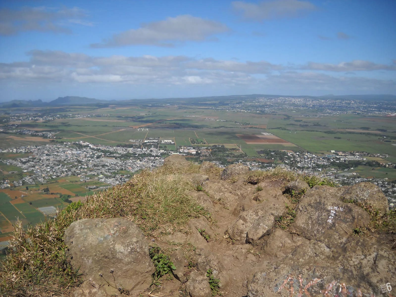
Why climb from the north
Most visitors climb Le Pouce from Petit Verger because it is short. The northern route from Port Louis is the one locals describe with respect. Le Mauricien calls the ascent via Le Dauguet very difficult, and a detailed description of the north route calls it more gradual but much longer, with better views and more shade than the Moka side. You start at about 88 m, barely above the harbour, and finish at 812 m, so the mountain gives you nearly all of its height.
The reward is a climb that watches Port Louis shrink beneath you, about 90 percent of it under trees according to the local press, with the city, the harbour and the northern plain opening up each time the woods thin. If you are staying in the capital and have a full morning, it is the more satisfying route. If you want the summit in two hours, it is not the route for you.
The route from Tranquebar, stage by stage
The stages below follow the mapped path from the end of Chateau d’Eau Street, with waypoints borrowed from a Visorando recording that starts a kilometre earlier at the Champ de Mars racecourse. Where a distance is quoted from that recording, it is measured from the racecourse, not from the street end.
The end of Chateau d’Eau Street
The route begins where Chateau d’Eau Street runs out in Tranquebar, a residential quarter on the southern edge of Port Louis directly below the mountain. Buses stop at Tranquebar (Cité Madelaine), and the Champ de Mars racecourse is about a kilometre away, which is where the Visorando loop starts.
Le Dauguet sports ground and nature trail
Le Dauguet is a sports area with parking, sanitary facilities and a small oratory. A looped nature trail starts here, mostly in woods, and the track up Le Pouce leaves from it. The Visorando recording reaches Le Dauguet at about km 1 and 66 m. This is the last place with any facilities.
Through the woods past temples and mango trees
The path climbs gently through secondary woodland, passing Hindu temples and old mango trees. The recording notes a temple at about km 2.6 and 198 m, with monkeys around it. Stay left at forks on the main trail, but avoid the significant left fork that drops to cross a stream, which leaves the Le Pouce route altogether.
The signboard where the path turns left and steepens
A signboard marks the point where the Le Pouce trail turns left and the real climbing begins. On the racecourse recording this signposted junction comes at about km 4.7 and only 271 m, which tells you how much ascent is still ahead. From here on the path is steep and stony, and blue and white painted stones every few hundred metres confirm the way.
The clearing over Port Louis and the shoulder
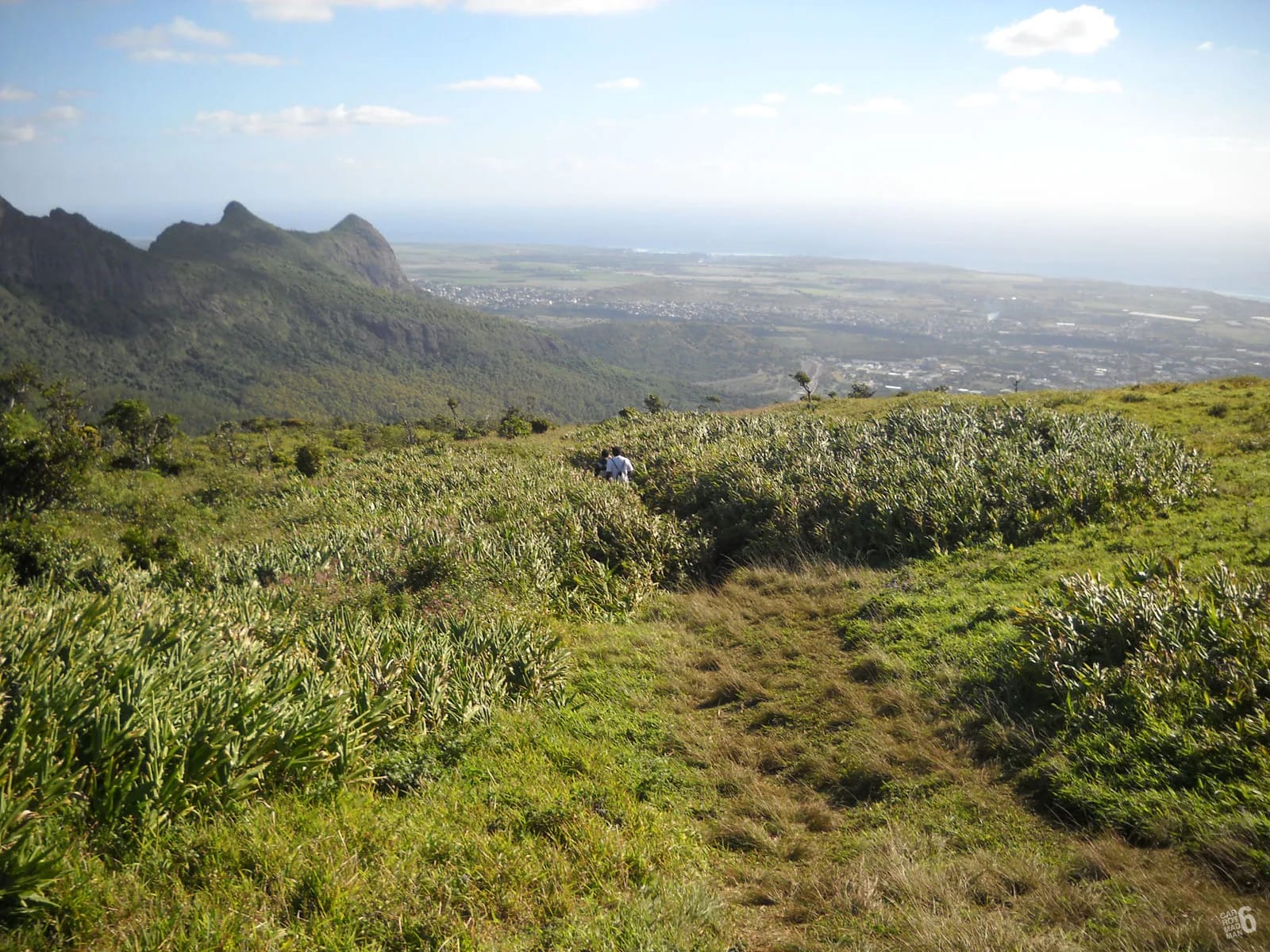
The woods open onto a clearing with the whole of Port Louis below, recorded at about 729 m, and shortly afterwards the path arrives on the grassy shoulder where the Petit Verger route comes up from the south. From here the two routes share the final climb.
The thumb and the summit
The last hundred metres are the same narrow trench and rock step that every Le Pouce hiker faces, steep, polished and exposed to one side. The Visorando walkers called the final climb technical. Use your hands, go one at a time and sit down on the small summit, which seats about six comfortably.
Down, by either side
Return the way you came for a long descent to Tranquebar, or drop south to Petit Verger and Saint-Pierre, about 2 km and an hour below the shoulder, and take a bus home. Decide before you leave the shoulder, because the two paths leave it on opposite sides and both are well trodden.
Joining the Petit Verger route on the shoulder
The two routes meet on the grassy shoulder at roughly 620 to 630 m, and the junction matters in both directions. Going up from Port Louis you simply turn onto the thumb, which is unmistakable. Coming down, a tired walker can take the wrong path. The Petit Verger route drops south into forest switchbacks towards Saint-Pierre, while the Port Louis path leaves to the north-west. If you have left a car at Le Dauguet, make sure you are heading north-west.
OpenStreetMap maps the Pouce to Port Louis path branching from the Le Pouce track a little over halfway up from the Petit Verger car park, at about -20.2005, 57.5244, on the approach to the shoulder. Download both GPX files from the map page and the junction looks after itself. Either way, look back at the shoulder as you arrive and fix in your mind which side you came up.
Distance and ascent, and why the sources disagree
The mapped path on this site runs 3.6 km from the end of Chateau d’Eau Street at about 88 m to the summit, gaining about 690 m with very little descent on the way. The Explore Mauritius description gives 6.3 km one way with 820 m of gain, and the Visorando loop from the Champ de Mars measures 14.12 km and 834 m of ascent in 6 hours 25 minutes. The differences come from where each record starts and whether it follows the direct path or wanders the nature trail and the streets. Plan on the longer figures and be pleased if the day turns out shorter.
We have not found a published time for the direct route from Tranquebar. Working from the Visorando pace, which reaches the summit a little after the 7 km mark of a loop timed at 6 hours 25 minutes, most walkers should allow about 3 hours up and 2 down, so a 5 to 6 hour day with rests. That is an estimate, not a measurement, and fit walkers on the direct path will do it faster.
| Source | Distance | Ascent | Time |
|---|---|---|---|
| Mapped path on this site | 3.6 km one way | About 690 m, from 88 m | Not timed |
| Explore Mauritius | 6.3 km one way | 820 m, from 83 m to 810 m | Not given |
| Visorando loop from the Champ de Mars | 14.12 km | 834 m | 6 h 25 |
| Petit Verger route, for comparison | 2.05 km one way | About 390 m, from 381 m | 2 to 3 h return |
The through-hike to Saint-Pierre, bus to bus
Because both trailheads have buses, Le Pouce can be crossed rather than climbed and descended. Start in Port Louis, climb from Tranquebar, cross the summit or the shoulder and descend to Petit Verger and Saint-Pierre, where National Transport Corporation routes 153 and 167 run to Réduit, Ebène, Quatre Bornes and Curepipe, and an unverified route 12 returns to Port Louis via Moka. The whole crossing is about 6 km on the direct paths, with nearly all the climbing on the Port Louis side.
Buses in Port Louis leave from two squares. Victoria Square serves the south and centre and Immigration Square the north, and the Tranquebar (Cité Madelaine) stop is on the southern edge of the city. Country buses run roughly 06:30 to 18:30 and city buses 05:30 to 20:00, so start early and aim to be in Saint-Pierre by mid-afternoon. Doing the crossing in reverse, from Saint-Pierre to Port Louis, gives a shorter climb and a long shaded descent, and finishes in the capital where buses are more frequent. The bus page has the detail.
Mosquitoes, stones and the temple monkeys
The northern side is wooded and damp, and the Visorando walkers reported many mosquitoes, so repellent is worth carrying here in a way it is not on the open Moka side. The path is very stony in its upper half and slippery when wet, and the long descent is hard on knees. Monkeys gather at the temple on the way up. They are long-tailed macaques, introduced by the Dutch four centuries ago, and hikers on Le Pouce describe them as close but not pushy. Keep food out of sight and do not feed them.
Water is the other difference. The route is nearly twice as long as the Petit Verger climb and there is no water on the mountain, so carry 2 litres per person and more in summer. Le Dauguet has sanitary facilities at the start, and nothing else on the route does.
Personal security at Le Dauguet
The lower part of the northern route passes through the edge of the city, and it has seen trouble. In October 2025 a group of British tourists and their elderly guide were robbed at knifepoint at Le Dauguet on their way up to Le Pouce. Nobody was hurt. In November 2022 two young French women were attacked on the mountain and robbed of their phones and cash. These are isolated incidents against the many walkers who climb here every week, but they are recent and they should shape how you go about the day.
- Walk in a group of three or more on the Le Dauguet section, and start in full daylight rather than at first light.
- Carry only what you need, keep your phone in a pocket rather than in your hand on the lower path, and leave jewellery at home.
- Tell someone your plan and your expected finish time, and check in when you are down.
- Police are on 999 or 112 and the SAMU ambulance on 114. Mobile coverage is decent on the ridges but patchy in the woods.
Questions people ask
Can you hike Le Pouce from Port Louis?
Yes. The northern route starts in Tranquebar where Chateau d’Eau Street ends, climbs past the Le Dauguet sports ground and nature trail, through woods and temples, and joins the Petit Verger route on the shoulder below the summit. It is about 3.6 km one way on the mapped path with roughly 690 m of ascent, and sources that include the approach streets give up to 6.3 km.
Where does the Port Louis route start?
At the end of Chateau d’Eau Street in Tranquebar, on the southern edge of Port Louis below the mountain, about a kilometre from the Champ de Mars racecourse. Le Dauguet, a sports ground with parking, sanitary facilities and a looped nature trail, is just above the street end and is where the track up the mountain leaves. Buses stop at Tranquebar (Cité Madelaine).
How long does Le Pouce take from Tranquebar?
We have not found a published time for the direct path. A Visorando loop from the racecourse reached the summit a little after 7 km of a 14 km walk timed at 6 hours 25 minutes, which suggests about 3 hours up and 2 down for most walkers, so allow 5 to 6 hours with rests. Fit walkers on the direct path will be quicker. Treat these as estimates.
Is the Port Louis route harder than Petit Verger?
Yes, for effort. It has about 690 m of ascent against 390 m and is nearly twice as long, with a steep, stony upper half once the path turns left at the signboard. The final scramble on the thumb is identical on both routes. The north is shadier and more gradual lower down, so it is harder on the legs but easier on the head until the shoulder.
Is it safe to hike Le Pouce from Le Dauguet?
Many people do, but there have been incidents. A group of tourists and their guide were robbed at knifepoint at Le Dauguet in October 2025 without injury, and two tourists were attacked on the mountain in 2022. Go in a group of three or more, start in full daylight, carry little and keep your phone out of sight on the lower section. Police are on 999 or 112.
Can I climb from Port Louis and come down to Moka?
Yes, and it is the best way to use this route. Climb from Tranquebar, cross the shoulder or the summit and descend the short Petit Verger route to Saint-Pierre, where buses on routes 153 and 167 run to Réduit, Ebène and Curepipe and an unverified route 12 returns to Port Louis. The crossing is about 6 km with nearly all the climbing on the north side.
See both routes on the map
The map page draws the Tranquebar and Petit Verger routes together, with elevation profiles, the shoulder junction and GPX files to download.