
Charles Darwin on Le Pouce, 1836
HMS Beagle anchored at Port Louis on 29 April 1836, near the end of its voyage round the world, and sailed again on 9 May. In between, Charles Darwin walked up Le Pouce, rode part of the way to Rivière Noire on the Surveyor-General’s elephant and wrote a short, sharp account of a sugar island newly under British rule. This page quotes what he actually said, sorts out the date and shows what a hiker can still recognise from the top.
Read the guide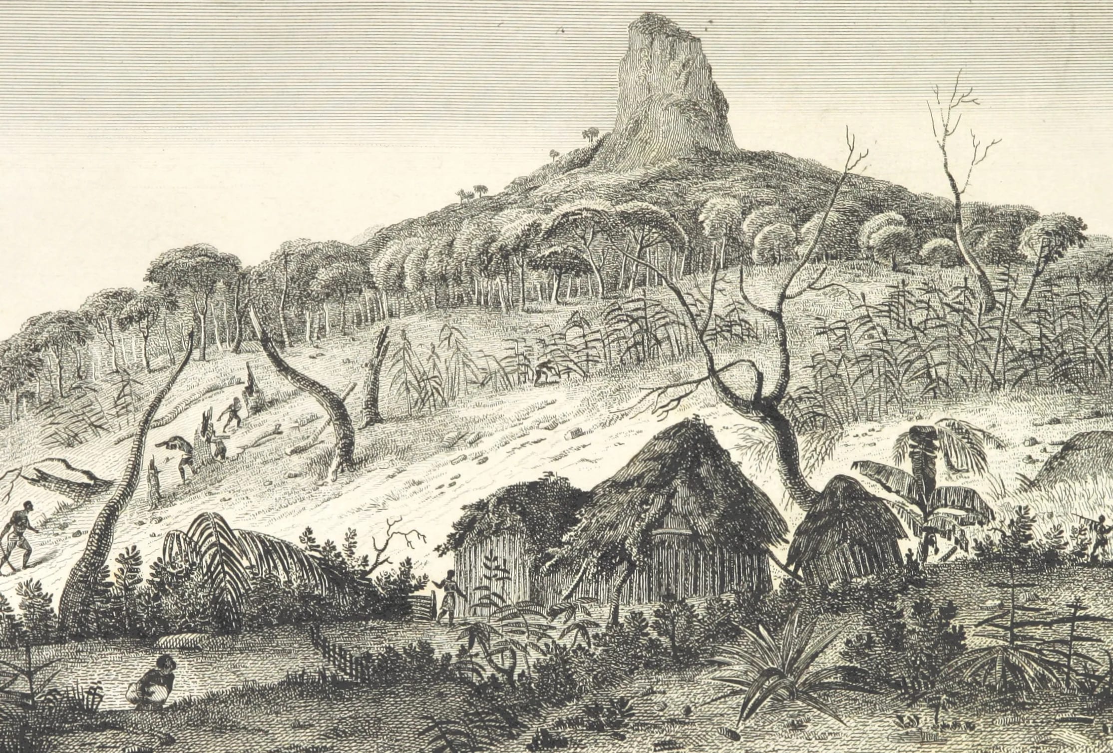
Ten days at the end of a long voyage
By the time the Beagle reached Mauritius, Darwin had been away from England for years and was impatient to get home. The ship anchored off Port Louis on 29 April 1836. His first impression was of the north-western coast, “The sloping plain of the Pamplemousses, interspersed with houses, and coloured by the large fields of sugar-cane”, with the mountains behind it “jagged into the sharpest points”. Anyone who has driven south from the airport or in from Grand Baie knows the scene he meant.
The Beagle stayed ten nights and sailed on 9 May. Darwin used the time for a walk along the coast, the climb of Le Pouce, an excursion inland to see raised coral rock near Rivière Noire and a round of observations on the volcanic structure of the island. He also looked at the town, the convicts working on its roads and the economics of sugar, and he wrote it all up with the brisk confidence of a man who had seen a great many islands by then.
Which day he climbed
Darwin never wrote the date of the ascent down as such. In the Journal of Researches the climb appears under the entry for Sunday 1 May, which describes a walk along the coast, and begins “The next day I ascended La Pouce”. Read literally, that puts him on the summit on Monday 2 May 1836, and that is the date given in the encyclopaedic entry for the mountain and in most modern accounts.
His Beagle Diary complicates it slightly, because the entry headed 2 May contains both the coastal walk and the same sentence about the next day. A note in the journal Nature in 1936 placed the walk on 1 May and the climb on the day after, while at least one Mauritian article gives 1 May for the climb itself. His small field notebook has no entry for Le Pouce at all. The safe statement, and the one this guide uses, is that Darwin climbed Le Pouce in early May 1836, most probably on 2 May.
What he wrote about the mountain
The passage every later writer quotes is short. “The next day I ascended La Pouce, a mountain so called from a thumb-like projection, which rises close behind the town to a height of 2,600 feet.” Three things in that sentence still hold. The name does come from the thumb-like projection. The mountain does rise close behind the town, closer than any other summit of its height on the island. And his estimate of 2,600 feet, about 790 m, is only some 20 m short of the modern figure of 812 m, which is good judgement for a man with no instrument but his eye. He wrote the name with a feminine article, La Pouce, where French has Le Pouce. The slip has been reprinted ever since, and this guide quotes it as he wrote it.
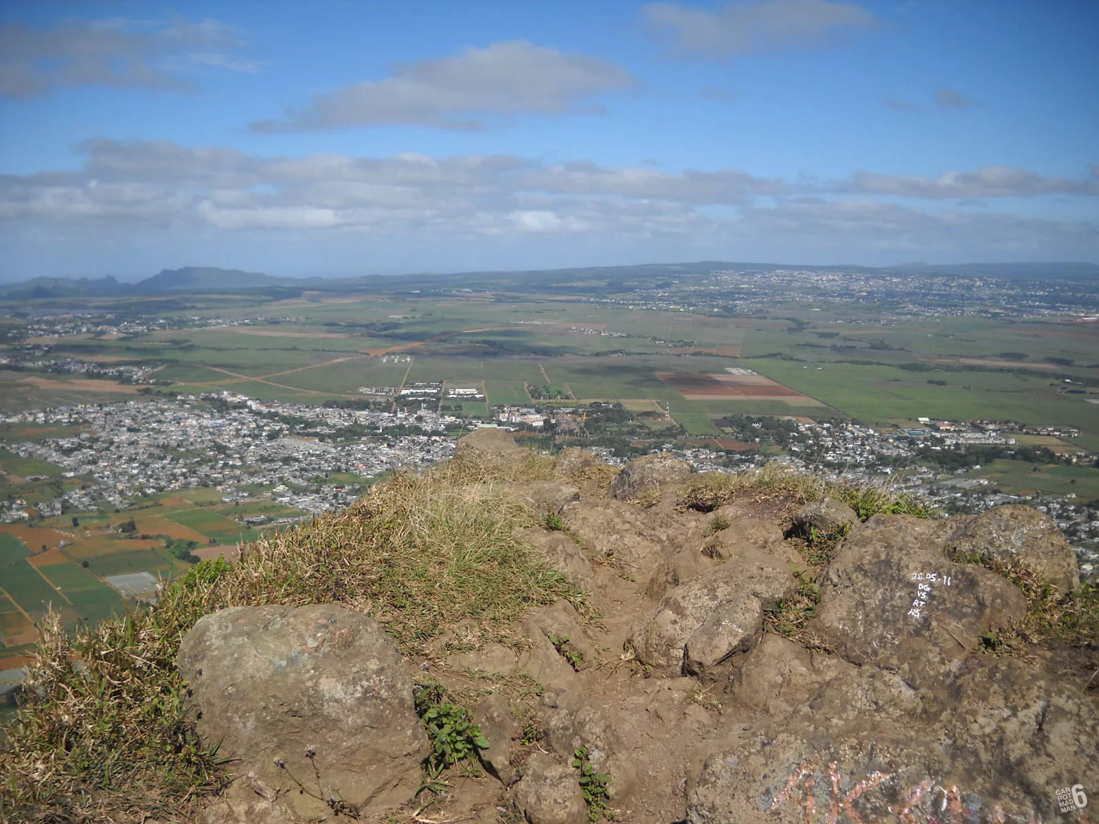
Then the view. “From our elevated position we enjoyed an excellent view over the island. The country on this side appears pretty well cultivated, being divided into fields and studded with farm-houses.” In his private diary the same moment reads a little differently, “From our elevated position, we enjoyed an excellent view over this great mass of volcanic matter”, which tells you what he was really looking at. He adds that he was told only about half the land was yet productive, a reminder that the Mauritius he saw was still being cleared.
Sugar, roads and a new colonial order
The view set him thinking about money. “Since England has taken possession of it, a period of only twenty-five years, the export of sugar is said to have increased seventy-five fold. One great cause of its prosperity is the excellent state of the roads.” The diary gives the same figure as a proportion of seventy-five to one. Mauritius had passed from France to Britain in 1810, so his twenty-five years are right, and he is careful to say the sugar statistic is one he was told rather than one he measured. He also noted that the British government was not popular with the French inhabitants, who had nonetheless done very well out of it.
He noticed, as a naturalist does, who was doing the work. In the same days he recorded about 800 Indian convicts employed on public works and planters beginning to bring in free Indian labourers. The Aapravasi Ghat on the Port Louis waterfront, where almost half a million indentured workers landed between 1834 and 1920, is now a UNESCO World Heritage Site. Darwin was describing the first two years of that system without any idea of what it would become, and his remark about the roads is a reminder that the prosperity he admired was built by the people he mentions in passing.
Captain Lloyd and the elephant
The elephant belongs to a different day and a different excursion. Darwin wanted to see the raised coral rock near Rivière Noire, and Captain John Augustus Lloyd, the Surveyor-General of Mauritius, helped him get there. “Captain Lloyd possessed an elephant, and he sent it half way with us, that we might enjoy a ride in true Indian fashion.” What struck Darwin was not the size of the animal but its silence. “The circumstance which surprised me most was its quite noiseless step.” His field notebook pins the day, with the entry “Rode on Elephant” under Thursday 5 May 1836.
Lloyd is worth a second look. Four years earlier, on 7 September 1832, he had been in the party that made the first recorded ascent of Pieter Both, the balanced-boulder summit along the ridge from Le Pouce, so Darwin’s host knew these mountains better than anyone on the island. People sometimes imagine Darwin riding the elephant up Le Pouce. He did not. He walked up the thumb one day and rode the elephant halfway to Rivière Noire on another.
His geological notes
Darwin was by then as much a geologist as a naturalist, and Mauritius gave him a clear case of something he had been turning over on earlier volcanic islands. “The centre of the island consists of a great platform, surrounded by old broken basaltic mountains, with their strata dipping seawards.” That ring of outward-tilted mountains was precisely the structure that the fashionable theory of craters of elevation claimed to explain by sudden uplift from below. Darwin noted that Mauritius fitted the description and then added, drily, “There appears to me to be insuperable objections to this view”.
His geological diary, written on the spot, records the hills around Port Louis as basalts and black trachytes, with solid layers alternating with cemented fragmentary rock, and puts the detached hills around the central plain at generally two to three thousand feet. The modern reading, that the ring is the eroded rim of an old shield volcano and the platform younger lava that filled its interior, is close to what he suspected. The geology page on this site takes the story on.
What a hiker can recognise today
Darwin does not say which way he went up, and nothing in the text settles it. The town was his base, so the northern slopes above what are now Tranquebar and Le Dauguet are a reasonable guess, but a guess is all it is. What you can do is check his sentences against the view from the top.
- The thumb-like projection is unchanged. Seen from the shoulder, the summit rock still looks exactly as the name says.
- It still rises close behind the town. Port Louis has grown up the lower slopes, so the summit is nearer the houses than it was in 1836.
- The excellent view over the island is still there on a clear morning, from the harbour to the northern islands and east to Pieter Both.
- The country on this side is still cultivated, but the fields and farm-houses of his day have become suburbs, a motorway and, further north, the cane plain of Pamplemousses.
- The roads are still good. The motorway you see running north from the capital is the modern version of the excellent state of the roads he praised.
- The great mass of volcanic matter is what you are standing on. Look along the ridge to Snail Rock and Pieter Both and you are seeing the broken rim he described.
Questions people ask
When did Darwin climb Le Pouce?
In early May 1836, during HMS Beagle’s stop at Port Louis from 29 April to 9 May. Most sources, including the encyclopaedic entry for the mountain, give 2 May, because his Journal describes the climb as the day after a coastal walk on Sunday 1 May. A 1936 note in Nature and at least one Mauritian article prefer 1 May. Darwin himself never wrote the date down.
How did Darwin get to the top of Le Pouce?
On foot. He does not say which route he took, and no source settles it; the slopes above Port Louis are the likeliest guess because the town was his base. The elephant that appears in every retelling belongs to a separate excursion towards Rivière Noire on 5 May, when Captain Lloyd sent it to carry him half way.
Why did Darwin write “La Pouce”?
It was simply his spelling. Pouce is a masculine noun in French, so the mountain is Le Pouce or the Montagne du Pouce, and Mauritians have never called it anything else. Darwin, writing in English from notes, gave it a feminine article and the error has been reprinted with the quotation ever since. This guide keeps his spelling inside quotation marks and the correct one everywhere else.
Did Darwin discover anything on Le Pouce?
No new species and no single discovery. What the climb gave him was a clear view of the structure of the island, a central platform ringed by old, outward-dipping basaltic mountains, which he used to argue against the then popular craters of elevation theory. His Mauritian notes on volcanic rock and raised coral fed into his later books on volcanic islands and coral reefs.
How long was Darwin in Mauritius?
Ten nights. The Beagle arrived on 29 April 1836 and sailed on 9 May. In that time Darwin walked along the coast, climbed Le Pouce, rode part of the way to Rivière Noire on Captain Lloyd’s elephant to look at coral rock, examined the volcanic hills around Port Louis and wrote about the town, its convicts and its sugar trade.
Where can I read Darwin’s account of Le Pouce?
The published version is chapter 21 of his Journal of Researches, often called The Voyage of the Beagle, which is out of copyright and freely available online. His private Beagle Diary, his geological diary and his small field notebook are transcribed on Darwin Online and on the Beagle Diary blog. Together they give the quotations used on this page and the slight differences between them.
Walk the mountain Darwin climbed
The hiking guide covers the Petit Verger route stage by stage, with honest notes on the thumb-like projection he described.