
Safety on Le Pouce
Le Pouce combines a walking approach with an exposed rocky finish. Wet ground, wind and fatigue can change the difficulty of either section. Plan your return before dark, walk with company and keep the option of stopping below the summit.
Read the guide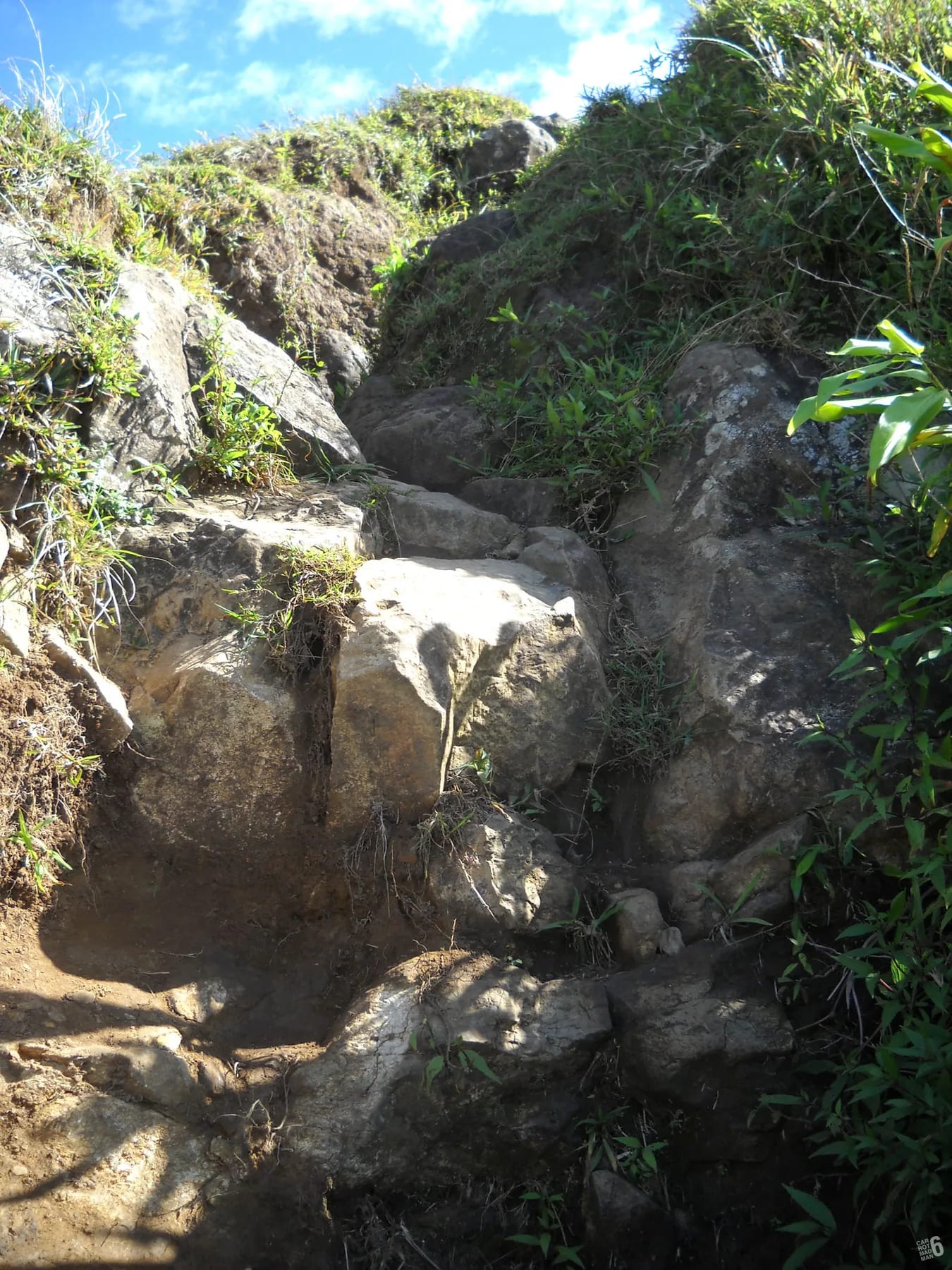
Where the risk actually is
From the Petit Verger car park at 381 m, the route climbs a farm track, then forest switchbacks, then an open grassy shoulder at roughly 620 m. The approach still needs suitable footwear, fitness and attention to the terrain. The character changes on the final spur, where the path narrows onto the thumb itself and the last hundred metres become steep, rocky and exposed. Hikers describe scrambling over ledges and short catwalks with real drops beside them, and the final thirty metres or so run along a trench in the ridge rock. The rock step at the very top needs a hand or two for a few metres.
Exposed here means what it says. A slip on the final spur would not be a tumble onto grass. People with a fear of heights usually find the trench the hardest part, not because the moves are technical but because the ground falls away on both sides and there is nowhere to step aside. The honest advice from people who have climbed it many times is that anyone who suffers from vertigo should stop at the shoulder, and that nobody should attempt the spur in strong wind or low cloud.
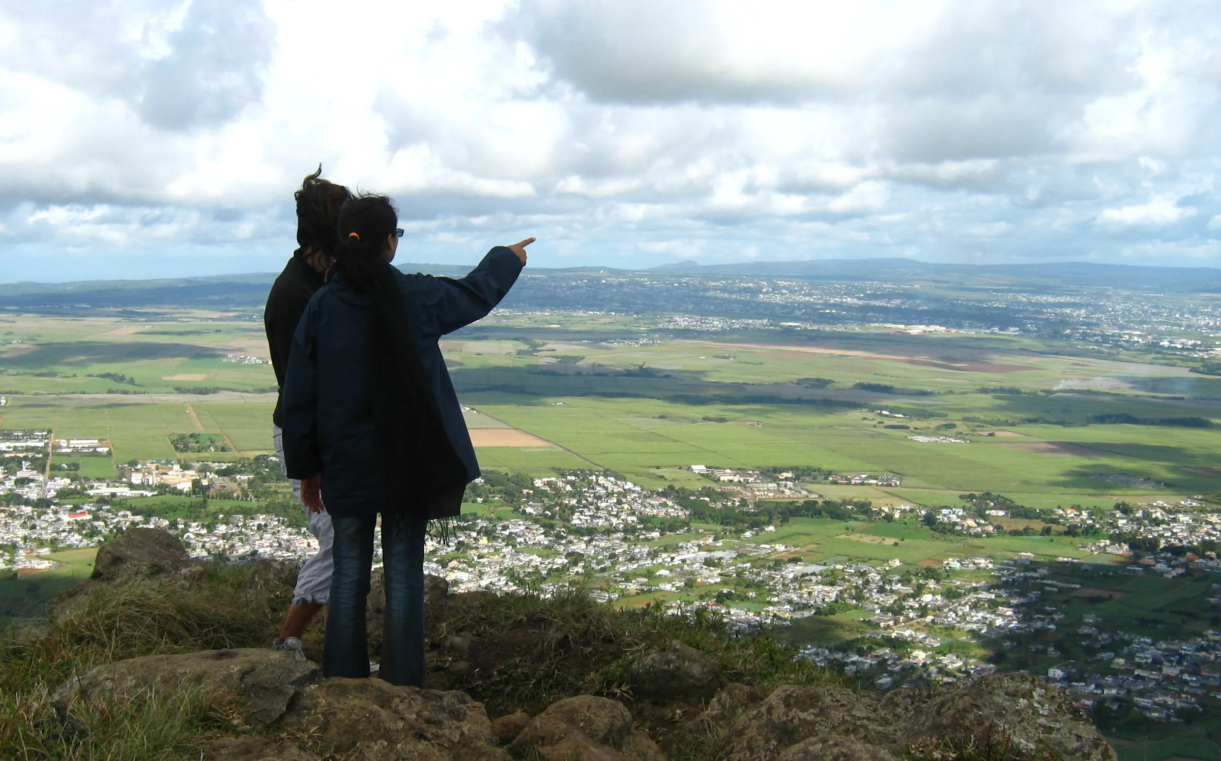
The shoulder is a real destination, not a consolation. It is where the view over Port Louis opens, where most groups rest, and where the summit photograph is often taken anyway. Decide before you leave the car park that the shoulder is where you will turn around if the final spur does not look right, and say so out loud to the people you are with.
Wet and muddy rock after rain
The mountain is basalt with a thin, clay-rich soil, and both behave badly when wet. After rain, and during the morning cloud that often sits on the summit, the rock polishes under boots and the path through the forest turns to mud. Hikers consistently report a slippery final climb and a very muddy descent. The woman carried down by stretcher in August 2026 sprained her ankle on the descent of the Saint-Pierre side, a reminder that tired legs and wet downhill ground can lead to injury.
Rain in the mountains of the centre is more frequent than on the coast, and the wettest months are February and March. If it has rained heavily in the last day or two, or if the summit is in cloud when you arrive, plan to go to the shoulder and no further. Wet rock on the final spur is the one condition where the mountain becomes genuinely dangerous for ordinary walkers.
- Wear shoes with real grip and a sole that sheds mud. Trainers with worn soles are the most common mistake on this path.
- Descend facing the slope on the steepest rock, and use your hands where you used them on the way up.
- Give yourself extra time for the descent. It takes most people as long as the climb when the ground is wet.
- Poles help on the muddy forest section but get in the way on the final scramble. Stow them before the spur.
Wind on the summit, heat on the slope and no water
The summit is small and stands clear of everything around it, so it catches the trade wind. Reports describe it as breezy on good days and windy on most, and sudden gusts near the top are a known feature. Wind on a narrow ridge is more than a nuisance. It affects balance on the trench and the catwalks, and strong wind is a reason to stay on the shoulder.
Below the summit the problem is heat. Once you leave the forest switchbacks the path is open, and from October to April the sun is strong from early in the morning. January and February bring daytime highs around 29 °C at the coast, and although the summit is roughly five degrees cooler by the usual lapse rate, you will be climbing in full sun on the way to it. There is no water anywhere on the route, no shop at the car park and no stream you should drink from. Carry 1.5 to 2 litres per person and start early.
A light wind layer weighs almost nothing and makes the summit comfortable rather than miserable. In winter, from June to September, night temperatures fall to around 16 °C at sea level, and a dawn start on the mountain is cool enough to want a second layer until the sun arrives.
Timing and the short dusk
Mauritius sits close to the tropic, and dusk here is short. Between sunset and real darkness there are about twenty minutes, and there is no daylight saving to stretch the evening. Sunset moves from roughly 17:40 in June to roughly 18:55 in January. Anyone still on the forest switchbacks when the light goes will be finishing by phone torch on a muddy path, which is how people get lost.
Most hikers take 2 to 3 hours for the round trip from Petit Verger, and 3 to 4 if they linger or the ground is wet. The Port Louis route is far longer, at roughly 3.6 km and 690 m of ascent one way, and a loop from the Champ de Mars has been recorded at over six hours. Work backwards from sunset, not forwards from your start, and leave the summit with at least two hours of daylight in hand on the Moka side and three on the Port Louis side.
| Month | Sunrise | Sunset |
|---|---|---|
| January | 05:42 | 18:55 |
| April | 06:20 | 17:59 |
| July | 06:45 | 17:46 |
| October | 05:39 | 18:12 |
A small summit that fills quickly
The summit is a small rocky point, not a plateau. Groups may have to wait below the final section. Visitor accounts of how many people fit are not an official safe capacity. Keep space around you and avoid crowding the edge.
Stay seated once you are up. Standing to take a photograph near the edge in gusty wind is the obvious mistake. Take your turn, take your picture, then move back down to the shoulder to eat and rest so that others can come up. If a large guided group is already on the spur, wait on the shoulder rather than passing on the narrow sections.
Personal security and the recorded incidents
Le Pouce is climbed every day by Mauritians and visitors, and the great majority of outings pass without incident. It is still a mountain with two very different approaches, and the Port Louis side deserves a plain word. In November 2022 two young tourists were attacked on the mountain by a man who threw a liquid at them and stole their phones, cash and a bank card. In October 2025 a visiting group and their elderly guide were robbed at knifepoint at Le Dauguet, on the Tranquebar approach, without injury. Both cases were reported in the Mauritian press and investigated by the police.
The lesson is not to avoid the mountain. It is to approach it as you would any quiet hill on the edge of a capital city. Go in a group, especially on the Port Louis side, keep valuables to a minimum and out of sight, and stay in daylight. The Moka side, from Petit Verger above Saint-Pierre, is described by the local press as the calmer start.
The mountain has also needed rescues. In October 2024 a hiker in his forties went missing and was found injured by police units, special-forces commandos and a helicopter. In August 2026 a woman hiking with her family sprained an ankle on the descent and was carried down on a stretcher by a police special unit. In August 2023 a local resident who set out on her usual late-afternoon walk did not return, and was found dead on the mountain about ten days later. These are stated here without names, because the point is the pattern. Injuries happen on the descent, searches happen when nobody knows where someone went, and late starts make both worse.
- Hike with at least one other person. The Port Louis side in particular is not a place to go alone.
- Carry only what you need. Leave passports, spare cards and jewellery at your accommodation.
- Keep phones in a zipped pocket rather than in your hand on the lower paths.
- Start in the morning and be off the mountain well before dusk.
- Leave nothing visible in a parked car, on either side.
Emergency numbers and who responds
The police emergency number in Mauritius is 999, and 112 also connects. The SAMU ambulance service is on 114. Mobile coverage on the ridges is generally decent, which is one reason to keep your phone charged rather than draining it on photographs. In the recorded Le Pouce incidents, the response has come from the regular police, police special units and commandos, the Special Mobile Force, a police helicopter and, in one search, dogs. None of that is guaranteed, and a stretcher carry down the Saint-Pierre side takes hours.
- Police 999, or 112 from any phone.
- SAMU ambulance 114.
- Fire service 115.
- If you cannot describe where you are, say which side you started from, whether you are above or below the shoulder, and how long ago you left the car park.
What to tell someone before you go
Searches on Le Pouce have started because nobody knew which route a walker had taken or when to expect them back. Before you set off, tell someone who is not on the mountain four things. Which trailhead you are starting from, whether you intend to go to the summit or only the shoulder, when you expect to be back at the car or the bus stop, and when they should call the police if they have not heard from you.
Set the alarm time generously but set it. A message when you are back down costs nothing. If plans change on the mountain, for example if you decide to cross from Moka to Port Louis instead of returning, send the update from the shoulder while you still have signal and attention to spare.
Questions people ask
Is Le Pouce safe to hike alone?
The Moka side from Petit Verger is walked every day and a solo hiker there in daylight is taking an ordinary risk. The Port Louis side has a record of robberies, most recently at knifepoint at Le Dauguet in 2025, and is not a place to go alone. In either case, tell someone your route and return time, keep to the marked path and be down before dusk. The recorded injuries happened on the descent, when a companion can fetch help.
Is Le Pouce dangerous?
The final section is steep, narrow and exposed. Wind, cloud and wet rock increase the risk. The approach can also be slippery or tiring. Stop below the summit or turn back earlier whenever conditions exceed your group’s ability.
Are there snakes or dangerous animals on Le Pouce?
Keep your distance from monkeys, do not feed them and keep food packed away. Use protection against mosquitoes. Do not leave the path to approach wildlife.
What should I do if someone is injured on the mountain?
Call 999 or 112 for police, or 114 for SAMU. Give your location, trailhead and nearest landmark, then follow the dispatcher’s instructions. Protect the injured person without putting yourself at risk. Mobile coverage and response times are not guaranteed.
Is the Port Louis side of Le Pouce safe?
It is the longer, quieter and more thinly marked approach, and the two recorded robberies, in November 2022 on the mountain and in October 2025 at Le Dauguet on the Tranquebar approach, both involved visitors. Go in a group, in the morning, with little of value, or hire a local guide who knows the neighbourhood. Many hikers do it without trouble, but it deserves more care than the Moka side.
Can I hike Le Pouce in the rain?
You can walk to the shoulder in light rain with the right shoes, and the forest section will be muddy. You should not attempt the final spur on wet rock, where the basalt polishes and the exposed ledges become dangerous. If it has rained heavily recently or the summit is in cloud when you arrive, treat the shoulder as your summit for the day.
Pack for the conditions
The kit list covers water, grip, sun, wind and the small things that make the exposed finish safer.