
Do you need a guide for Le Pouce?
No guide, permit or fee is required to climb Le Pouce from either side. The standard route from Petit Verger is waymarked in blue and white, the path is obvious underfoot and the mountain is climbed every day by people who have never been up it before. Self-guided hikers still need to get a handful of things right, and there are a few situations where paying for a guide is money well spent.
Read the guide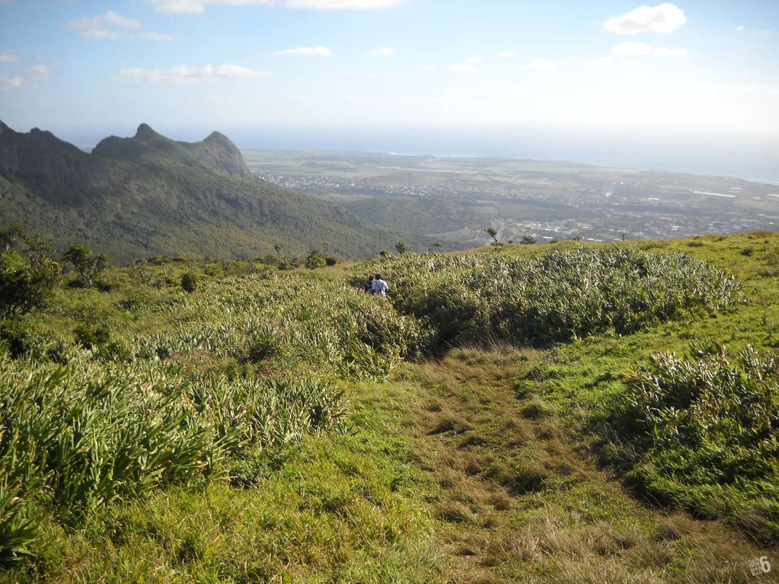
No guide, no fee, no permit
Le Pouce asks nothing of you at the gate. There is no entrance fee, no booking and no obligation to hire a guide, unlike Le Morne, where the upper section is managed by a heritage trust, or Pieter Both, where the summit boulder needs ropes and a guide in practice. The summit of Le Pouce is reached by a walking path with a short scramble and no climbing gear.
Part of the mountain is a nature reserve, and access can be restricted. The usual route is described in the sources as having no hiking ticket or permit, but this guide does not confirm daily opening. Follow Forestry Service notices, posted restrictions and local instructions. Stay on the paths and leave plants and wildlife undisturbed.
How the waymarks work
The Petit Verger route carries blue and white paint on wooden posts, on tree trunks and on rocks beside the path, with roughly fifteen signposts over the two kilometres to the summit. A wooden board at the start lists the classic Pouce route alongside the longer options towards Le Dauguet and the Moka Range. The marks are frequent on the lower section and thin out on the open shoulder, where the path is obvious enough not to need them.
On the Port Louis side the marking is a line of blue and white painted stones every few hundred metres, which is enough to confirm you are on the main trail but not enough to choose for you at every fork. Visitors who have hiked marked trails in Europe should not expect the density of signage they know from home. One careful travel writer called the start not well signposted, and that is fair. The marks confirm, they do not lead.
Trail visibility on the mapped route is recorded as excellent in OpenStreetMap, and in dry weather the path is a worn line that is hard to lose. The difficulty is not in following the path but in picking the right branch at the three or four places where it splits.
The junctions to watch
From Petit Verger, the route makes sense if you remember one rule given by hikers who have done it repeatedly. At every junction, keep the summit on your left and keep climbing. The places where people hesitate are listed below.
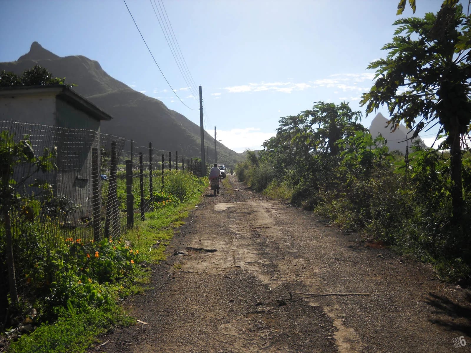
From Tranquebar the rule is different. Stay left at the forks on the main trail as it passes temples and mango trees, until a signboard where the Le Pouce trail turns left and steepens. One large left fork lower down crosses a stream and is a trap. The mapped GPX for that side is the surest way to confirm you are on the right line.
The kiosk junction, about 500 m in
After the farm track through the cane, the path reaches a large kiosk at about 437 m. Paths leave it in more than one direction. Take the one that climbs towards the mountain, not the one that continues level around the hillside.
The Port Louis branch, roughly halfway
About halfway between the car park and the summit a path branches off to the north-west and descends towards Tranquebar and Le Dauguet. It is the through-route to Port Louis and it is signed, but if you are not planning to cross the mountain it is a mistake that costs an hour. Stay on the climbing path.
The shoulder and the plateau at about 620 m
On the open grassy shoulder the path spreads into several lines. Any of them works. Aim for the base of the thumb, where the single path to the summit begins. Do not follow trodden lines off the shoulder to the north, which lead to viewpoints and then nowhere.
The final spur
There is only one way up the thumb. If you find yourself on a faint line that is not climbing, you are off it. Return to the last clear mark rather than pushing on through scrub.
Download the GPX and work offline
Both routes on this site are mapped from OpenStreetMap geometry with a terrain-model elevation profile, and both can be downloaded as GPX files. The Petit Verger route is 2.05 km one way with about 390 m of ascent from the car park at 381 m. The Port Louis route from Tranquebar is about 3.6 km one way with roughly 690 m of ascent from about 88 m. Load the file into any mapping app before you leave your accommodation and make sure the base map is stored offline.
Mobile coverage on the ridges is generally decent, but a map that depends on a data connection is the wrong tool for the one place you will need it, which is a fork in the forest where the signal has gone. A GPX track also settles the question of the Port Louis branch in seconds. If the dot is drifting away from the line, turn around.
- Download the route before arrival and open it once to be sure the app can read it.
- Carry a power bank or start with a full battery. Navigation and photographs drain a phone in a morning.
- Note the car park position, about 20.2077 south and 57.5270 east, so you can find your way back to it from the shoulder if you descend a different line.
Check the weather for the summit, not the coast
A forecast for the beach says nothing useful about an 812 m summit. The mountain makes its own cloud, which is why it holds a cloud forest in the reserve, and hikers regularly describe arriving at a clouded-over summit with no view, or meeting sudden rain and strong wind near the top in weather that was fine in Moka. Check a forecast for the Central Plateau or for Moka specifically, and look at the mountain from the motorway before you commit.
Cloud at the summit may lift or persist. Assess wind, visibility and recent rain across the whole route before starting. Postpone under warnings or after heavy rain. Do not continue automatically to the shoulder if conditions are deteriorating.
Turnaround discipline at the shoulder
The shoulder at roughly 620 m is where every self-guided hiker should make an honest decision. Below it the route is a walk. Above it the path narrows onto the thumb, becomes steep and exposed, and finishes with a trench in the ridge and a short rock step that needs hands. In wind, in cloud, on wet rock, with a tired child or a nervous partner, the correct decision is to stop.
This is harder than it sounds, because the summit looks close and other people are coming down from it. Set the rule before you leave the car park and treat it as a decision already made. The view from the shoulder over Port Louis is the view most people came for, and nobody at the bottom will ask whether you touched the top.
When a guide genuinely helps
A guide is not needed for navigation on the Petit Verger route, but there are situations where one changes the day.
The guided hikes page explains how these outings run and what to ask before booking.
- Your first mountain. If you have never been on a steep, exposed path, a guide shows you where to put your hands and feet on the spur and takes the decision-making off your shoulders.
- You are nervous of heights. A guide who knows the trench can talk you through it, or tell you honestly that today is a shoulder day.
- The Port Louis side. The Tranquebar approach is longer, less marked and has a record of robberies, most recently at knifepoint at Le Dauguet in 2025. A local guide is company, a navigator and a deterrent.
- You want the history and the plants. Darwin climbed this mountain in 1836, the reserve holds plants found nowhere else, and a good guide turns a two-hour walk into a morning you remember.
- You have no car. Most guided outings include a transfer or a meeting point that saves a complicated bus connection.
Go with someone
Self-guided does not mean solo. The recorded incidents on Le Pouce, from the ankle carried down by stretcher in 2026 to the robberies on the Tranquebar side, all argue for company. A second person can fetch help, share water, hold a phone steady for the emergency call and say no to the final spur when you need to hear it. If you must go alone, choose the Moka side, go in the morning, tell someone your plan and your return time, and keep to the marked path.
Questions people ask
Is the Le Pouce trail well marked?
Well enough. The Petit Verger route has blue and white paint on posts, trees and rocks, with roughly fifteen signposts, and the path itself is a clear worn line. The Port Louis side has painted stones every few hundred metres and more forks. Neither is marked to European standards, so carry the GPX track and remember to keep the summit on your left at junctions from Petit Verger.
Can I climb Le Pouce without a guide if I have never hiked?
Yes, to the shoulder, which most people reach in under an hour and which has the main view. The final spur is steep and exposed, and a first-time hiker should be honest about whether narrow ground with drops beside it is something they want to try without an experienced friend. Many first-timers stop at the shoulder and are glad they came.
Do I need a permit for the nature reserve?
The sources consulted describe no hiking permit for the usual route. This is not a daily access confirmation. Follow Forestry Service notices and any restrictions posted at the trailhead.
What should I do if I lose the path?
Stop, open the GPX track and walk back to the last blue and white mark you saw. Do not push on through scrub or down a gully in the hope of rejoining the route. The paths that leave the shoulder to the north end at viewpoints with drops. If you have no track and no marks in sight, retrace your steps until you find one, then rejoin the main line.
Which side is easier to navigate without a guide?
The Moka side from Petit Verger. It is shorter, better marked, more walked and described by the local press as the calmer start. The Port Louis side from Tranquebar is longer, has more forks, including a false left fork across a stream, and has a record of robberies, most recently at Le Dauguet in 2025. Self-guided first visits should start from Petit Verger.
Is it OK to hike Le Pouce alone?
Many people do on the Moka side, in daylight, and come to no harm. It is still better with a companion, because the recorded injuries on this mountain happened on the descent, and a sprained ankle alone on a muddy path is a long afternoon. On the Port Louis side, do not go alone. Whichever side, tell someone your plan and your return time.
Get the route on your phone
The map page has both routes with elevation profiles and GPX files to download before you go.