
The view from the summit of Le Pouce
Most people climb Le Pouce for the view, and on a clear morning it earns the effort. From the thumb you look straight down on Port Louis and its harbour, north across the cane plain to the islands off the top of Mauritius, east along the ridge to the balanced boulder of Pieter Both and south over Moka to the towns of the Plaines Wilhems. This page describes what is where, when the air is clearest and why the top is sometimes inside a cloud.
Read the guide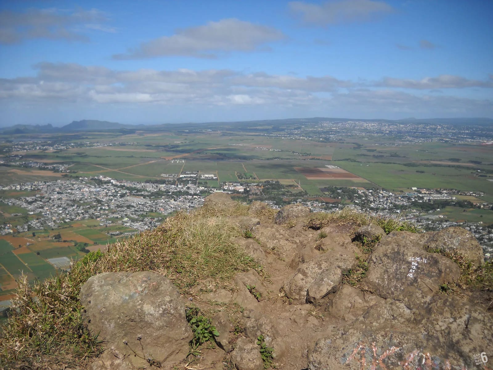
Port Louis and the harbour below you
The capital fills the bowl between the Moka Range and the sea, and from the summit you see all of it at once. The harbour is the obvious anchor, with its container terminal and the Caudan waterfront along the inner basin. Nearer the mountain, the oval of the Champ de Mars racecourse, where the Mauritius Turf Club first raced in 1812, sits in a natural amphitheatre with the older streets of the city around it. The Citadel, Fort Adelaide, is the squat fort on the low hill between the racecourse and the water. Beyond the city, Signal Mountain and the lower hills on the far side of the bowl close the view to the west.
Darwin stood here in early May 1836 and wrote that from his elevated position he enjoyed “an excellent view over the island”, with the country on this side “pretty well cultivated, being divided into fields and studded with farm-houses”. Where he saw fields and farmhouses, you now see the suburbs of Port Louis running up to the foot of the mountain and the motorway heading north out of the city. The shape of what he described, a town on the water with a plain behind it and mountains all round, has not changed.
The northern plain and the islands
North of the city the land flattens into the plain of Pamplemousses, the sugar country Darwin saw on arrival as “the sloping plain of the Pamplemousses, interspersed with houses, and coloured by the large fields of sugar-cane”. It is still cane for the most part, with villages and the botanical garden set into it. Beyond the plain the coast runs round to Cap Malheureux at the northern tip of the island.
On a clear morning you can pick out Coin de Mire, the wedge-shaped islet off that northern tip, and the low line of Île Plate behind it. These are the farthest things you are likely to identify from Le Pouce, and they are not visible every day. Summer haze and the afternoon build-up of cloud usually hide them, so if the islands matter to you, come between May and November and be on top before mid-morning.
Pieter Both to the east
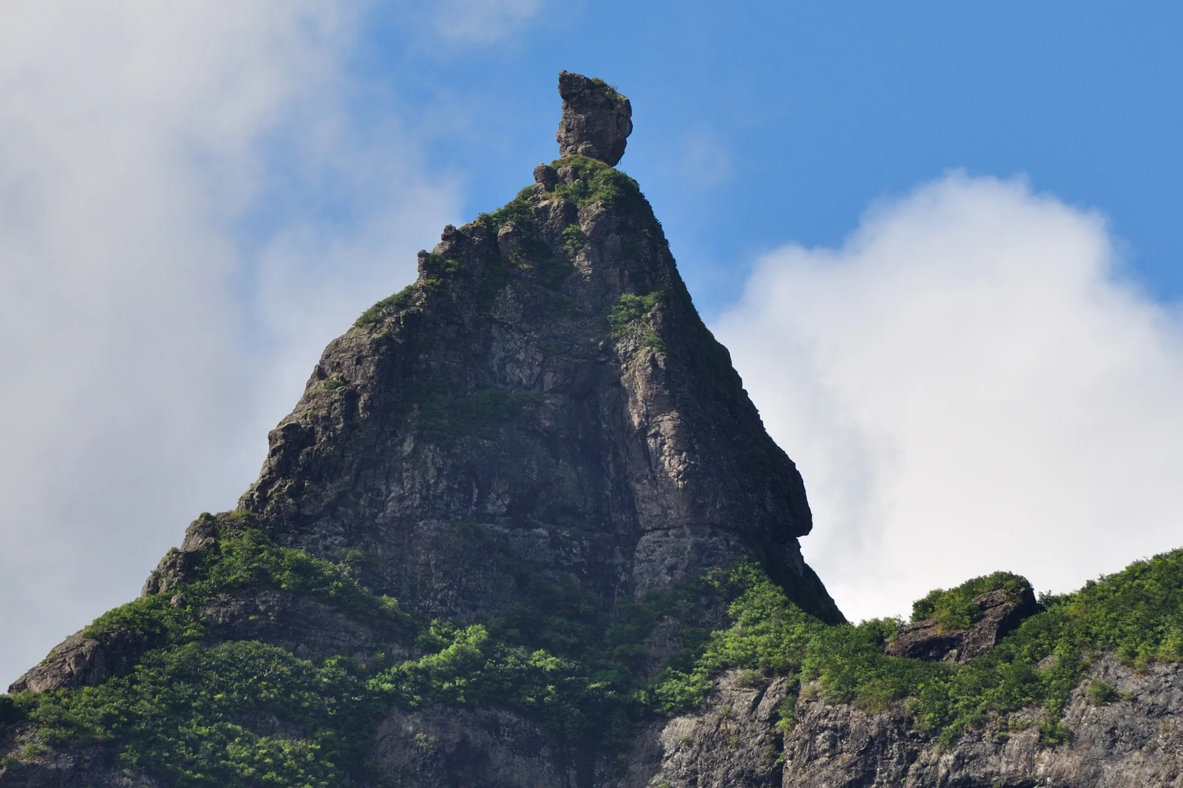
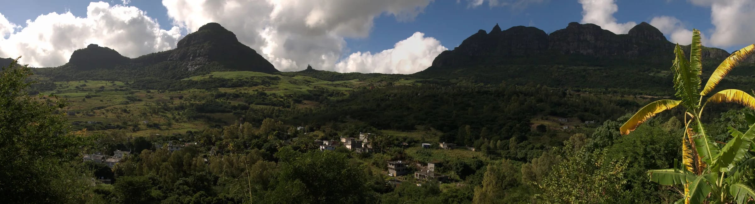
Turn east along the ridge and the skyline belongs to Pieter Both, 820 m, about 2.7 km away in a straight line. Its summit boulder, which looks like a head balanced on a pair of shoulders, is visible even from the grassy shoulder below the thumb, and from the summit you can follow the whole saddle that connects the two mountains. The Moka Trail’s Petit Both race runs to that col, but no published walking route follows the ridge all the way across, and this guide does not suggest improvising one. Pieter Both’s final boulder needs ropes and a guide, and the two mountains are compared on their own page.
Snail Rock, Berthelot Peak and the view south
West-north-west along the ridge the next summit is Snail Rock, 620 m, which you will already have seen as the trail wrapped around the mountain. South of you Berthelot Peak is the prominent point. Below it the land falls away to Moka and Saint-Pierre, with the cane fields of Petit Verger and the lane you drove up, and somewhere in the trees are Le Réduit and Eureka. Further round to the south-west the towns of the Plaines Wilhems, Beau Bassin-Rose Hill, Quatre Bornes and their neighbours, climb towards the central plateau in an almost unbroken spread of roofs.
Milbert drew exactly this side in 1812, in a plate titled, in translation, a view of the Plaines Wilhems taken at the base of the Montagne du Pouce, when the plain below was forest and plantation. Hikers describe the summit as giving a full circle of views, and this southern half is the part most people photograph least and remember longest, because it shows how much of the island is lived in.
Landmarks by direction
Directions below are approximate compass bearings from the summit. On the mountain itself the simplest reference is the thumb. Stand on the shoulder with the summit rock in front of you and Port Louis is down to your left, Pieter Both is behind the thumb to your right and Moka is at your back.
| Direction | What you see | Notes |
|---|---|---|
| North-west | Port Louis, the harbour, the Champ de Mars and the Citadel | Directly below, visible on almost any day the summit is clear of cloud |
| North | The Pamplemousses cane plain and the north coast | Coin de Mire and Île Plate appear beyond it on clear days |
| East-north-east | Pieter Both, 820 m, and the saddle between the two mountains | About 2.7 km away; the boulder is visible from the shoulder too |
| West-north-west | Snail Rock, 620 m | Seen first as the trail wraps around the mountain |
| South | Berthelot Peak, then Moka, Saint-Pierre and Petit Verger | The side you climbed from; Le Réduit and Eureka are in the trees |
| South-west | Beau Bassin-Rose Hill, Quatre Bornes and the Plaines Wilhems | Towns running up to the central plateau |
When the view is clearest
The clearest air comes in the cooler, drier months from May to November, and on most days the best of it is early. Cloud builds on the summits as the day warms and heat haze flattens the northern plain by late morning even when the sky stays blue. The Mauritius Meteorological Services give October as the driest month on the island and February and March as the wettest, with about two thirds of the year’s rain falling between November and April. A winter sunrise climb is the surest way to the long view, and the sunrise page covers times and timing month by month.
Wind matters as much as cloud. The summit is breezy on a calm day and genuinely windy on many others, and the people who climb here regularly advise care on the final rocks in wind or after heavy rain. A clear, still morning after a front has passed through is the day to aim for.
Why the summit is sometimes inside a cloud
Le Pouce catches cloud. The highest peaks of the Moka Range receive extra moisture from the cloud that sits on them, which is why a native cloud forest survives on this mountain and nowhere else in the range. The same cloud can take the view away. Hikers describe morning fog that made the final rocks slippery, sudden rain and strong wind near the top, and at least one walker reached the summit inside a cloud and saw nothing at all.
Cloud caps often come and go over half an hour, so a wait on the shoulder sometimes pays. If the top stays in cloud, remember that the shoulder itself, between roughly 620 and 730 m, is often below the cloud base and still looks straight down on Port Louis. Do not go up the final spur in low cloud or strong wind for the sake of a view you will not get.
The summit itself
The summit is a small rock platform, not a viewing terrace. It is comfortable for about six people and uncomfortable above ten, and at weekends it fills up. The last 30 m or so is a trench along the ridge with a rock step that takes a hand or two, and there are real drops on both sides. Sit down, especially in wind, keep your bag close and give the people behind you room to arrive. The view is the same whether you stand on the very top or sit a few metres back on the spur, so there is no need to crowd the highest rock.
Questions people ask
Can you see Pieter Both from Le Pouce?
Yes. Pieter Both is about 2.7 km to the east-north-east along the same ridge and its balanced summit boulder is unmistakable. You can see it from the grassy shoulder below the thumb as well as from the summit, so you do not need to climb the final spur for that particular view.
Can you see the sea from Le Pouce?
Yes, to the north and north-west. The harbour of Port Louis is directly below, the north coast lies beyond the Pamplemousses cane plain and on clear days the islands off Cap Malheureux show above it. The view to the south is of Moka, the Plaines Wilhems towns and the central plateau rather than of coast.
Is there still a view if I stop at the shoulder?
A very good one. The shoulder looks straight down on Port Louis and the harbour, west to Snail Rock and east to Pieter Both. What you lose by not climbing the final spur is the full circle, in particular the uninterrupted view south over Moka. For many people, and for anyone uneasy with drops, the shoulder is the right place to stop.
What is the best month for a clear view from Le Pouce?
The dry, cool months from May to November give the most reliable visibility, and October is the driest month in the official climate record. Within any month, early morning is clearer than afternoon, because cloud builds on the summits and haze thickens over the plain as the day warms.
Is it windy on the summit of Le Pouce?
Usually. Hikers describe the top as breezy at best and often windy, and the final rocks are narrow enough that wind matters. Sit down on the summit, keep hats and loose items secured, and if the wind is strong enough to unbalance you on the shoulder, do not go up the spur at all.
How far can you see from Le Pouce?
No one has published a measured figure, so this guide does not invent one. The farthest landmarks people reliably identify are Coin de Mire and Île Plate off the northern tip of the island, and they are only visible on clear days. On a hazy summer afternoon the view can shrink to the city below and the ridge beside you.
Pick a clear day
The weather page explains cloud, wind and rain on the summit month by month, with a live panel for today.