
Photographing Le Pouce
Le Pouce is one of the most photographed shapes in Mauritius because it is one of the simplest. A thumb on a ridge above a capital city is hard to get wrong, yet most pictures of it are taken from the same two spots. This page sets out where the profile reads best, when the light falls on each face, what the summit frames hold and what the old engravings prove about the view.
Read the guide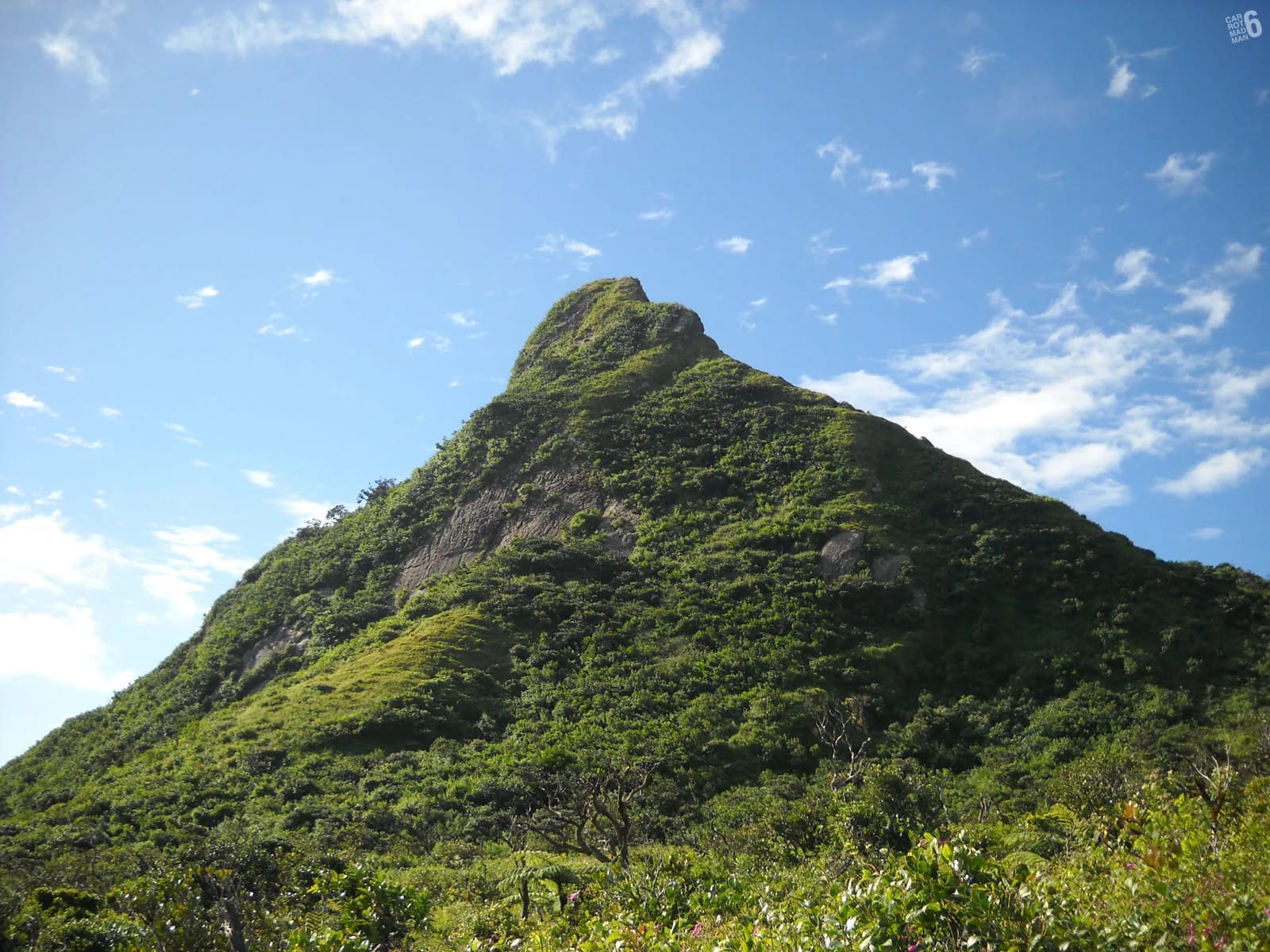
Where the thumb reads best
The thumb is a summit block set on a long shoulder, and it only looks like a thumb from certain sides. From the south, on the Petit Verger approach above Saint-Pierre, you see it end-on and tall. The farm road through the cane, the brown Le Pouce sign at the sharp bend and the grassy meadow at about 620 m all give clean foregrounds with the block rising straight above. This is the frame that explains the name, and it is the one to take if you only take one.
From Port Louis the thumb rises directly behind the town. The waterfront at the Caudan, the harbour and the Champ de Mars all put the city in the foreground, with the thumb reading as a sharp point above the roofs. Higher, from the Citadel, the racecourse fills the bottom of the frame and the whole Moka Range runs across the top. From the north, on the plain around the Vallée des Prêtres and Pamplemousses, the range stands as a wall and the thumb and Pieter Both’s head are its two unmistakable landmarks, the view Darwin described on arrival in 1836. From the Pieter Both side, at La Laura, the thumb is seen across the col with the ridge between the two mountains running towards you.
| Viewpoint | What you see | Best light | How to get there |
|---|---|---|---|
| Petit Verger approach, Moka side | The thumb end-on above cane and meadow, the classic profile | Morning, with the sun from the east and before cloud gathers | Farm road off the B47 between Moka and Saint-Pierre to the small car park at 381 m |
| Port Louis waterfront and Champ de Mars | The thumb rising behind the city | Afternoon, with the sun from the west | Central Port Louis, on foot |
| The Citadel, Fort Adelaide | Racecourse in the foreground, the whole range behind | Afternoon, or soft light under high cloud | Short climb above the Champ de Mars |
| The northern plain, Vallée des Prêtres and Pamplemousses | The range as a wall, thumb and Pieter Both’s head side by side | Morning for the ridge line, afternoon for the faces | Roads and bus routes north of the capital |
| La Laura, Pieter Both side | The thumb across the col with the ridge between | Morning | Village road in Moka District |
| Le Pouce summit and meadow | Port Louis, the harbour, the north coast, Pieter Both | Sunrise and the first two hours of the day | The hike itself |
The light, hour by hour
Mauritius keeps UTC+4 all year with no daylight saving, and the day is short at both ends. Sunrise in Port Louis runs from about 05:22 in November to 06:45 in July, sunset from about 17:38 in June to 18:55 in January. Dusk lasts around twenty minutes. The Moka side faces the rising sun, so the Petit Verger approach has its light in the first hours and the cane is at its greenest before the haze builds. The Port Louis face takes the afternoon sun from the west, which is when the thumb stands warmest against the sky from the Caudan or the Citadel.
Cloud is the other half of the light. The highest peaks of the range draw moisture from passing cloud, which is why Le Pouce keeps a cloud forest, and the summit can sit under a cap while the plain below is in full sun. Hikers report morning fog on the final rocks, sudden rain and strong wind near the top, and at least one party reached a summit with no view at all. The cooler, drier months from May to November give the clearest air. Summer carries 67 per cent of the island’s rain, February and March are the wettest months and October the driest. A cap of cloud on the thumb is a picture in its own right from below, but it is no picture from above, so if the top is hidden when you park, photograph the mountain and leave the summit for another day.
The frames from the summit
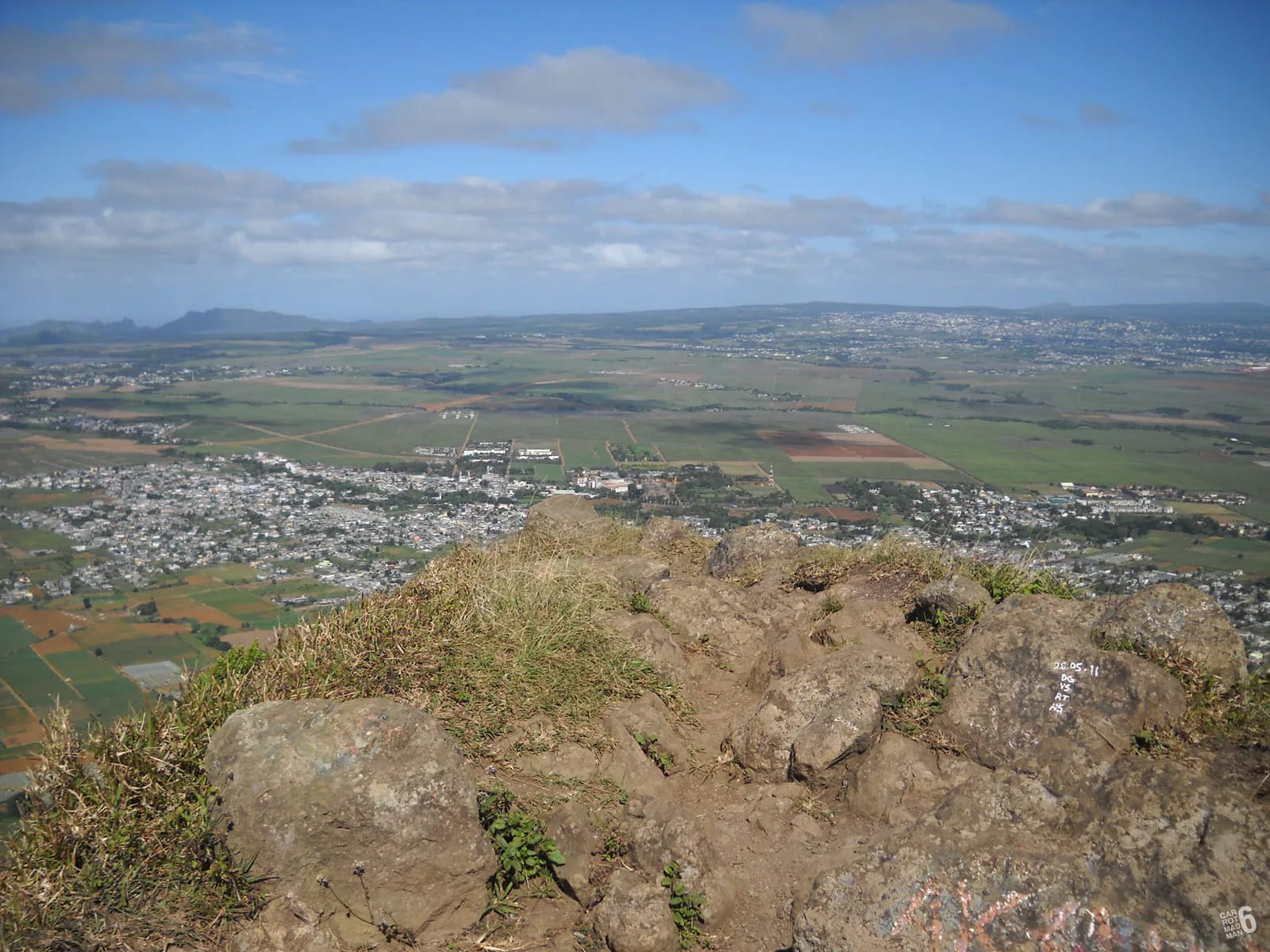
The summit is small. Hikers describe it as crowded with six people and uncomfortable above ten, and the Mauritian press advises staying seated when it is windy. That shapes how you photograph from it. Wait your turn, step back from the edge and work the two main directions. Towards the north-west, Port Louis fills the foreground, with the harbour, the Champ de Mars and the Caudan, and on a clear morning the north coast runs out to Coin de Mire and Île Plate. A wide lens takes the city and the sea in one frame.
Towards the east-north-east, Pieter Both’s head stands on its shoulders about 2.7 km away, with the ridge of the range running towards it. This is where a longer lens earns its weight, because the balanced boulder is small at that distance and a tight frame shows the shoulders beneath it. To the south the view opens over Moka and the plateau towns of Beau-Bassin Rose-Hill and Plaines Wilhems, with Berthelot Peak prominent nearby. The meadow below the summit gives most of the same views with room to set up, and on a busy morning it is the better place to work.
Frames along the route
The approach has its own pictures. The kiosk junction a few hundred metres above the car park, at about 437 m, frames the trail against the cane. The switchbacks through forest and the rock cuts are shaded and good in flat light. The grassy plateau at roughly 620 m is where Pieter Both first appears across the col and where the thumb rises straight ahead, the frame that makes most people stop. On the last spur the path narrows into a trench along the ridge, and the sight of hikers against the sky on that final climb, taken from the meadow, is the honest picture of what the finish involves.
What the old pictures prove
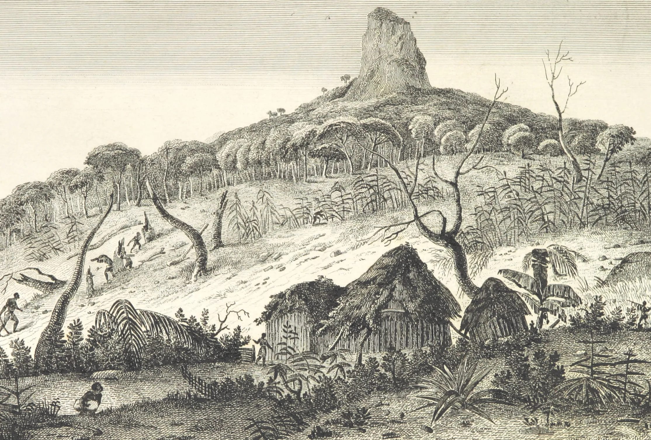
Le Pouce has been drawn and engraved for more than two centuries, and the pictures are useful because they show how little the mountain and its view have changed. Matthew Flinders, detained on the island from December 1803 until 1810, made a pencil drawing looking to the sea from the shoulder of Le Pouce that is now in the National Maritime Museum in Greenwich. In 1812 Jacques-Gérard Milbert, who had left the Baudin expedition at Mauritius in 1800, published the atlas of his Voyage pittoresque à l’Île de France, and page 49 carries a view titled Île-de-France, Vue de la Montagne du Pouce, the thumb standing above huts and palms. Darwin, climbing in May 1836, put the summit at about 2,600 feet and found fields and farmhouses below.
Two decades later the artist Wilhelm Heine, travelling with Commodore Perry’s expedition to Japan, drew Mauritius when the flagship Mississippi called there. His plates in the Narrative of the Expedition include a view of the port from the Pouce, confirmed in the Senate printing of 1856, and a view of Port Louis from the sea in the 1857 edition published by Appleton in New York, with Le Pouce and Pieter Both behind the town. On 1 July 1861 Le Tour du Monde published Évremond de Bérard’s engraving Île Maurice. Le Pouce. Set any of these beside a photograph from the same angle and the ridge line, the thumb and the curve of the harbour match. The town has spread, roofs have replaced cane in places, and the Caudan waterfront, opened in 1996, has changed the harbour’s edge, but the mountain is the fixed point in every frame.
People, drones and the reserve
The route passes a rock shrine on the Moka side and a Hindu temple on the Port Louis side, and the summit is a shared, cramped place. Ask before you photograph people at prayer or at rest, keep off the shrine itself, and do not hold the summit for a long set-up while others wait. On the north-western flank you are inside a nature reserve that holds a screwpine known from two individuals in the world. Stay on the path for the sake of the plants rather than the picture.
Drones are regulated. The Department of Civil Aviation’s published guidance for leisure drones under 7 kg says no permission is needed, but only by day, only over private property with the owner’s permission, below 400 feet, and never over any area where the public can gain access. The Le Pouce trail, the meadow and the summit are public-access land and partly nature reserve, so a lawful leisure flight there is very hard to arrange. This page does not claim that Le Pouce sits inside a specific airport zone, because no such zone was found in the sources used. The general rule is restrictive enough on its own.
Questions people ask
Where is the classic view of Le Pouce?
From the south, on the approach from Petit Verger above Saint-Pierre, where the thumb stands end-on above the cane and the meadow. From Port Louis the second classic view is from the waterfront or the Citadel, with the city in the foreground and the thumb directly behind it. Both are easy to reach on foot or by car.
What time of day is best for photographing Le Pouce?
Morning for the Moka side and for anything from the summit, because the air is clearest before cloud and haze build. Afternoon for the Port Louis face, which takes the western sun. Sunrise from the top falls between about 05:22 in November and 06:45 in July, and dusk lasts only about twenty minutes.
Will the summit be in cloud?
Often, and sometimes all day. The highest peaks of the Moka Range draw moisture from passing cloud, which is why Le Pouce has a cloud forest. May to November gives the clearest air. If the thumb is capped when you reach the car park, photograph it from below and keep the summit for a clear morning.
Can I fly a drone on Le Pouce?
Realistically no. Mauritian guidance for leisure drones allows flight only by day, over private property with the owner’s permission, below 400 feet and never over areas open to the public. The trail and summit are public land and part of the mountain is a nature reserve. Nothing here claims a specific airport zone, because the general rule is enough.
Which lens should I bring?
A wide lens for Port Louis and the north coast from the summit, and something longer for Pieter Both’s head across the col, which is small at 2.7 km. Keep the kit light, because the final spur needs a free hand, and pack it so nothing swings against the rock while you climb.
Is sunrise on Le Pouce good for photographs?
Yes, when the sky is clear. First light reaches the summit and the high ground before the city below, and the air is at its stillest. You will be climbing the last rocks in the dark, so a head torch and a known route matter more than any camera. The sunrise page gives times by month.
Plan the dawn climb
The sunrise page gives summit times by month and explains how to climb the last rocks in the dark.