
Port Louis, the capital at the foot of Le Pouce
Port Louis lies at sea level directly below Le Pouce, close enough that Darwin described the mountain as rising behind the town. The capital is dense, hot and rewarding for half a day, with a market building from 1839, a UNESCO site, a fort with the best view back at the thumb and a waterfront to finish. This is the hiker’s version of the city, covering what to see, in what order, and how it connects to both trailheads.
Read the guide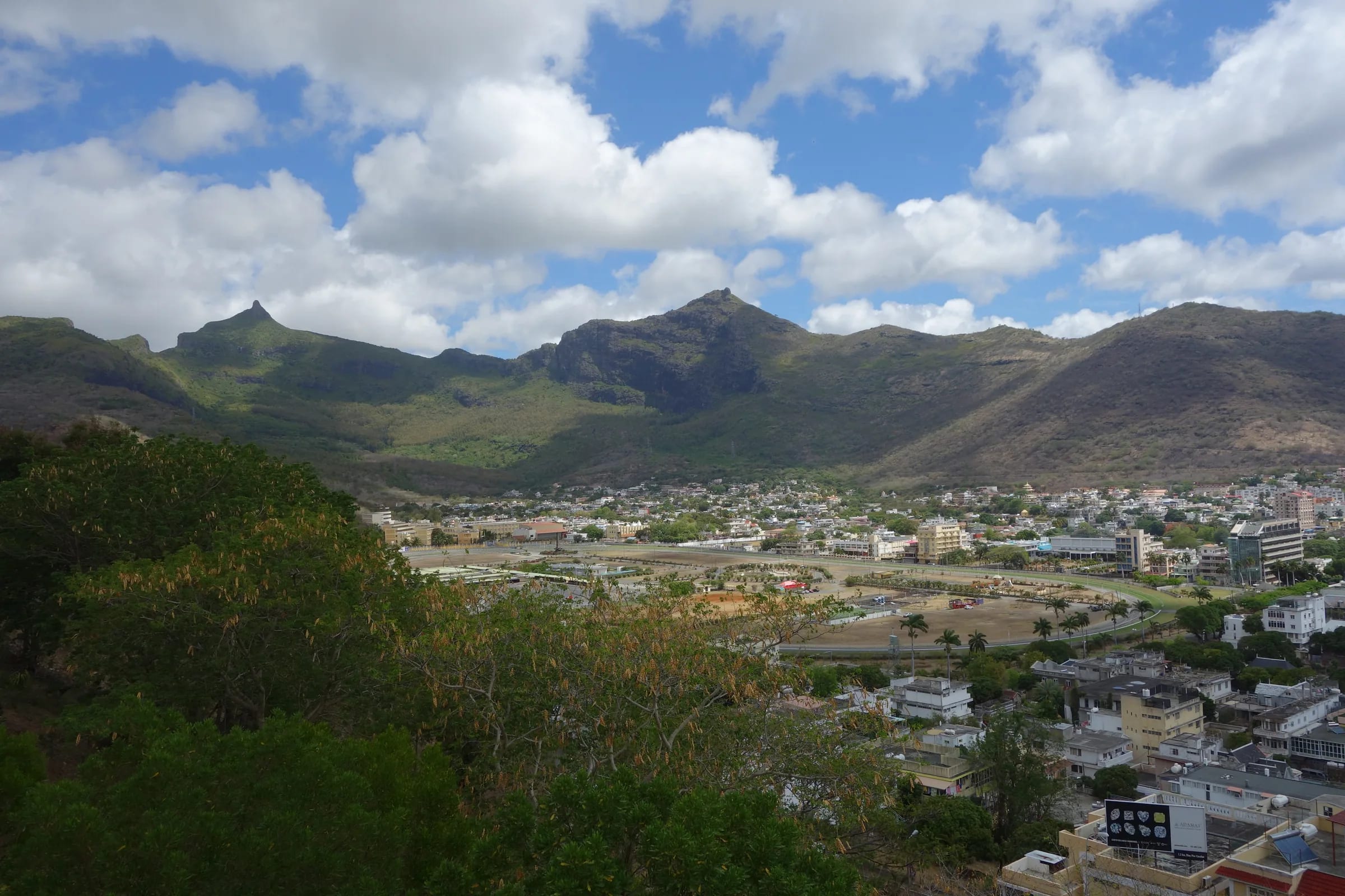
How the mountain rises behind the town
Stand at the Champ de Mars or on the Citadel and the geography explains itself. Port Louis fills a shallow bowl between the harbour and a semicircle of mountains, the Moka Range, which runs for about 20 km and wraps the city on three sides. Le Pouce is the sharp peak almost due south of the centre, about 5 km from the Central Market in a straight line and 812 m above it. Charles Darwin, who climbed it in early May 1836, described a thumb-like projection that rises close behind the town, and the description still fits.
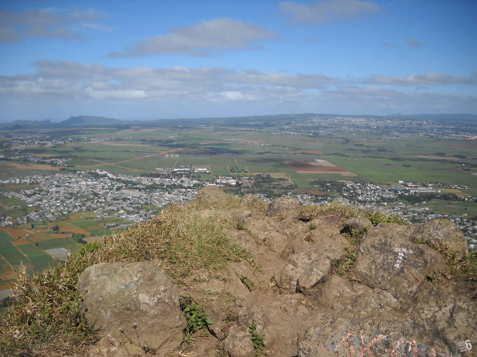
The two sides of the mountain are very different. The city side is dry, hot and steep, with about 711 mm of rain a year at the harbour, roughly a third of the island average, and more than 2,800 hours of sunshine. The summit often gathers cloud on afternoons when the streets are in full sun, so the view from town is best early and the view from the top is best earlier still. The Moka side, beyond the ridge, is higher, greener and quieter, and it is where most hikers start.
Half a day in the capital, in a sensible order
Most hikers come down from Le Pouce by late morning. Whether you descended to Tranquebar or drove round from Petit Verger, the following order keeps the walking short and ends at the viewpoint when the light on the mountain is kindest. Allow four to five hours including lunch. The centre is compact, and everything below lies within about 1.5 km of the Central Market except the Citadel, which is a short, steep walk above the racecourse.
Central Market first
Go while the fruit and vegetable halls are busiest and the food stalls are frying. Buy what you need for the afternoon and eat a dholl puri standing up.
Aapravasi Ghat
A short walk towards the harbour and the bus station. The site is small, so give it 45 minutes and read as you go rather than treating it as a photo stop.
Chinatown and lunch
Walk back inland a couple of blocks to Royal Street for lunch, then rest out of the sun during the hottest hour of the day.
Caudan and the Blue Penny Museum
Cross to the waterfront for the museum, the craft market and a coffee with the harbour in front of you.
The Citadel last
Walk or take a taxi up to Fort Adelaide in the late afternoon, when the sun is lower, the city has its colour back and Le Pouce stands clear above the roofs.
The sights at a glance
The table gives the sights most hikers combine with the mountain, the date that anchors each one and the reason to go. Distances are straight-line measurements from the Central Market, so the real walk through the streets is a little longer.
| Sight | Anchor date | Why go | From the market |
|---|---|---|---|
| Central Market | Building since 1839 | Produce, spices, street food, the city at its liveliest | Start here |
| Aapravasi Ghat | Depot 1849, UNESCO 2006 | Where almost half a million indentured workers landed | About 200 m |
| Chinatown | Settled from the late 1700s | Lunch, shophouses, one of the oldest Chinatowns in Africa | A couple of blocks north |
| Caudan Waterfront | Opened 24 November 1996 | Harbour front, craft market, cafés, shade | About 500 m |
| Blue Penny Museum | Opened 2001 | The 1847 Post Office stamps and the island’s history | About 500 m, at the Caudan |
| Champ de Mars | Racecourse since 1812 | Site of the independence ceremony, 12 March 1968 | About 1.2 km |
| Citadel, Fort Adelaide | Built 1834 to 1840 | The best view back to Le Pouce | About 1 km, uphill |
The Central Market and Chinatown
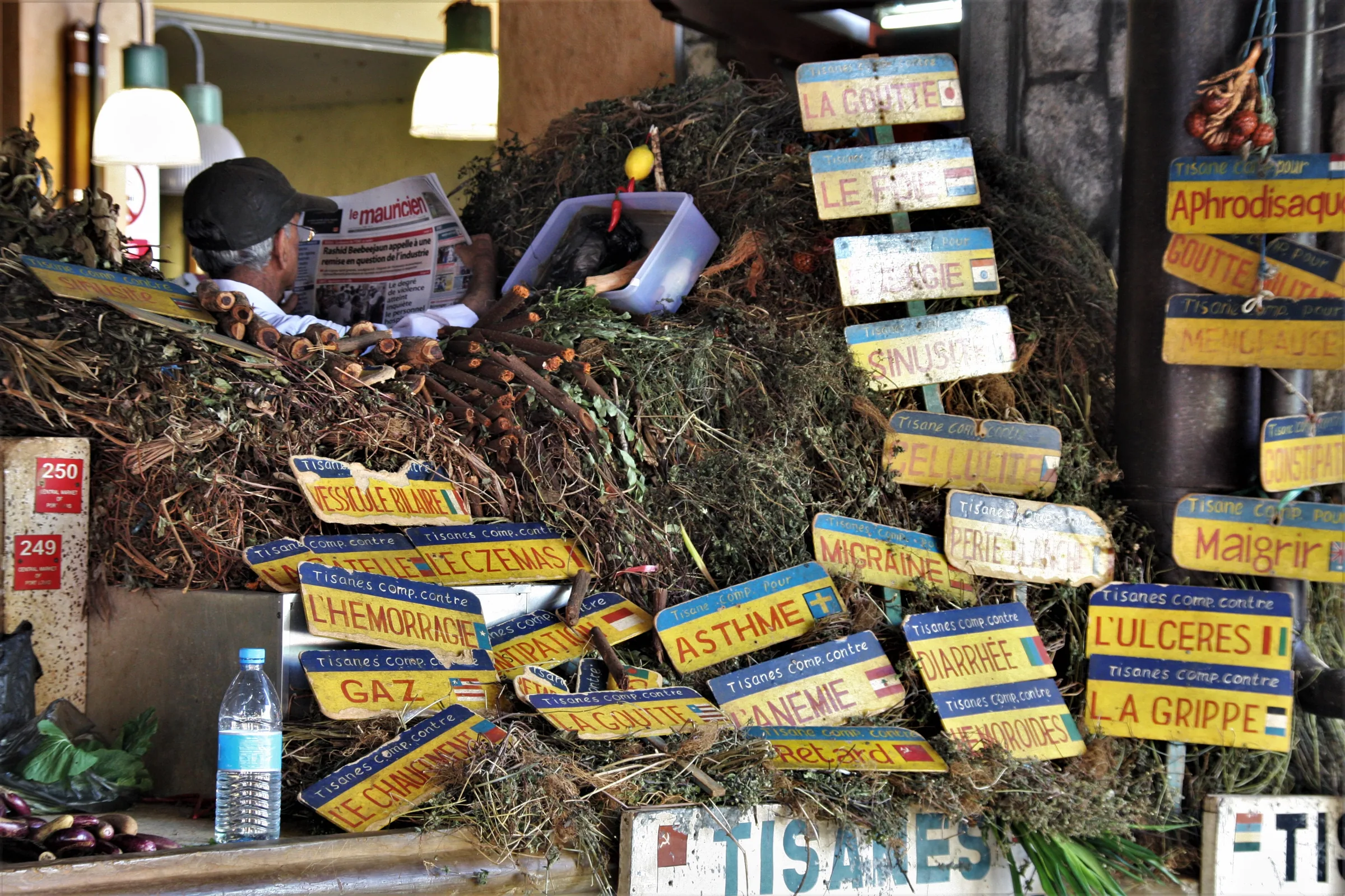
The Central Market stands on Farquhar Street on what used to be the Bassin des Chaloupes, the boat basin of the old harbour, and the building you walk into has stood since 1839. Three wrought-iron gates with floral designs and stone arches lead into halls for fruit, vegetables, spices and dried goods. A fire in the late 1990s damaged the building badly, and the renovation that followed added a new building, so part of the market feels old and part feels new.
What is sold tells you about the island. Mangoes and lychees in summer, jackfruit, tomatoes, chillies and coriander, tandoori and vindaloo powders, salted fish and dried octopus from Rodrigues, and a growing share of crafts now imported from Madagascar, Mozambique and India rather than made here. A dholl puri, a thin flatbread filled with split peas and served with butter bean curry, rougaille, coriander and pickles, is eaten standing up, and an alouda, a cold milk drink with basil seeds and jelly, is the right thing after a hot descent.
Chinatown begins a couple of blocks north of the market around Royal Street. Chinese traders were settling in Port Louis from the late eighteenth century, and the quarter they made, first called the Camp des Chinois, is counted among the oldest Chinatowns in Africa. It is a working neighbourhood of shophouses and wholesalers rather than a showpiece, which is its appeal, and the annual Chinese Food and Cultural Festival fills Royal Street with stalls and people from every community on the island.
Aapravasi Ghat and the story of indenture
Between the market and the harbour, a few steps from the bus station, stand the remains of the immigration depot built in 1849. Between 1834 and 1920 almost half a million indentured labourers, most of them from India, landed here to work on the sugar estates after the end of slavery, and UNESCO inscribed the site in 2006 for its place in the history of indentured labour. It is a modest site of stone steps, walls and a few buildings, and it carries far more than its size suggests.
The connection to the mountain is closer than it looks. When Darwin walked these streets in 1836, two years into the system, he noted convict labourers on public works and planters already bringing in workers from India, and the Citadel on the hill above was built largely by indentured hands. The sugar economy that paid for the town, and that Darwin saw laid out in fields from the summit, was built by the people who came through this gate.
The Citadel, the best view back to the mountain
Fort Adelaide, which everyone calls the Citadel, sits on the hill of Petite Montagne above the racecourse. Funds were voted in 1832 and the fort was built between 1834 and 1840, with some accounts putting the start a year earlier or later, on the site of an older French work. The British built it out of fear that France might try to retake the island, largely with indentured labour, and named it after Queen Adelaide, the wife of William IV. It is a two-storey basalt fort used today for occasional concerts, with shops in the old barracks.
For a hiker it is the one place in town not to miss. From the ramparts the whole semicircle of the Moka Range stands behind the city, with Le Pouce the obvious point almost due south, and you can pick out the valley above Tranquebar where the city-side route climbs. Below you lies the Champ de Mars, opened on 25 June 1812 by the Mauritius Turf Club and the oldest racecourse in the southern hemisphere, where the flag of independent Mauritius was first raised on 12 March 1968. Racing runs from late March to early December, and on a race day the whole quarter changes character.
Caudan Waterfront and the Blue Penny Museum
The Caudan takes its name from Jean Dominique Michel de Caudan, a settler who worked saltpans on this peninsula from 1726. The old docks were redeveloped from 1994 and the waterfront opened on 24 November 1996, with a second phase in 2007 and a 430-seat arts centre in 2018. It is the orderly, shaded counterpart to the market, with a craft market, cafés, a cinema and a casino, and it is where most visitors end the afternoon.
The Blue Penny Museum, open since 2001, holds two of the rarest stamps in the world, the orange-red one penny and the deep blue two pence of 1847, printed with the words Post Office instead of Post Paid. The rest of the museum is a compact history of the island and its harbour, and it is a good place to make sense of the port you have just been looking down on from the summit.
Tranquebar, Le Dauguet and the buses
Port Louis has its own way up the mountain. From the south-western suburb of Tranquebar, where Chateau d’Eau Street ends, a path climbs past Le Dauguet, a looped nature trail with a car park and toilets about 1 km in, then through woods and past temples to a signboard where the Le Pouce trail turns off and steepens. Our mapped route from the top of Tranquebar is 3.6 km one way with about 690 m of ascent, while descriptions that start lower in the city give 6 to 7 km. It is longer, shadier and more gradual than the Moka side, and far quieter.
Buses make a through-hike possible. Victoria Square, next to the market, is the terminus for the south and centre of the island, including services towards Moka and Saint-Pierre, while Immigration Square handles the north. Buses run from about 05:30 to 20:00 in town, and the Metro Express has linked Port Louis to Rose Hill since January 2020, with a branch to Ebène and Réduit. Timetables change, so check the day before. Two incidents, a robbery of two visitors on the mountain in 2022 and of a hiking group and their guide at Le Dauguet in 2025, mean the city-side approach is best walked in company, early, with little worth stealing.
Questions people ask
Can you see Le Pouce from Port Louis?
Yes. The peak stands almost due south of the centre, about 5 km from the Central Market in a straight line, and it is visible from the Champ de Mars, the Citadel and much of the waterfront. Darwin described it in 1836 as a thumb-like projection rising close behind the town. Tall buildings now hide it from some streets, so the Citadel is the reliable viewpoint.
How far is Port Louis from the Le Pouce trailhead?
The city-side trailhead is inside Port Louis, at the top of Tranquebar. The Petit Verger car park on the Moka side is about 6 km from the market in a straight line and roughly 20 to 25 minutes by car through Mount Ory and Moka, longer in the morning rush. By bus, services from Victoria Square towards Moka and Saint-Pierre bring you to within walking distance of the cane road.
Is half a day enough for Port Louis?
For a hiker, yes. The Central Market, Aapravasi Ghat, Chinatown, the Caudan and the Blue Penny Museum all sit within about 1.5 km of each other, and the Citadel is a short, steep walk above the racecourse. Four to five hours with lunch covers them without rushing. The Natural History Museum with its dodo gallery is the obvious addition if you have longer.
Which bus station do I need?
Victoria Square, beside the Central Market, serves the south and centre of the island, including Moka and Saint-Pierre for the Petit Verger trailhead. Immigration Square, a few hundred metres north near Aapravasi Ghat, serves the north, including Pamplemousses. Buses run from about 05:30 to 20:00 in town. Routes and timings change, so confirm at the station the day before rather than relying on an online timetable.
What is the best viewpoint over Port Louis itself?
From the city, the Citadel. From above, the summit of Le Pouce, which looks straight down on the harbour, the Champ de Mars and the whole plan of the town, with the north coast and its islands beyond on a clear morning. Signal Mountain on the other side of the city is the other local walk, but Le Pouce is the one that puts the capital at your feet.
Climb from the city side
The Port Louis route page describes the Tranquebar and Le Dauguet approach stage by stage, with the junctions to watch.