
The Le Pouce hike from Petit Verger
Le Pouce is the thumb-shaped peak of the Moka Range, 812 m high and the third-highest point in Mauritius. The standard route starts at Petit Verger above Saint-Pierre, on the quiet Moka side, climbs about 390 m in roughly 2 km and takes most people 2 to 3 hours there and back. Nearly all of it is a straightforward walk. The last hundred metres to the summit are not, and that is where this guide spends its care.
Read the guide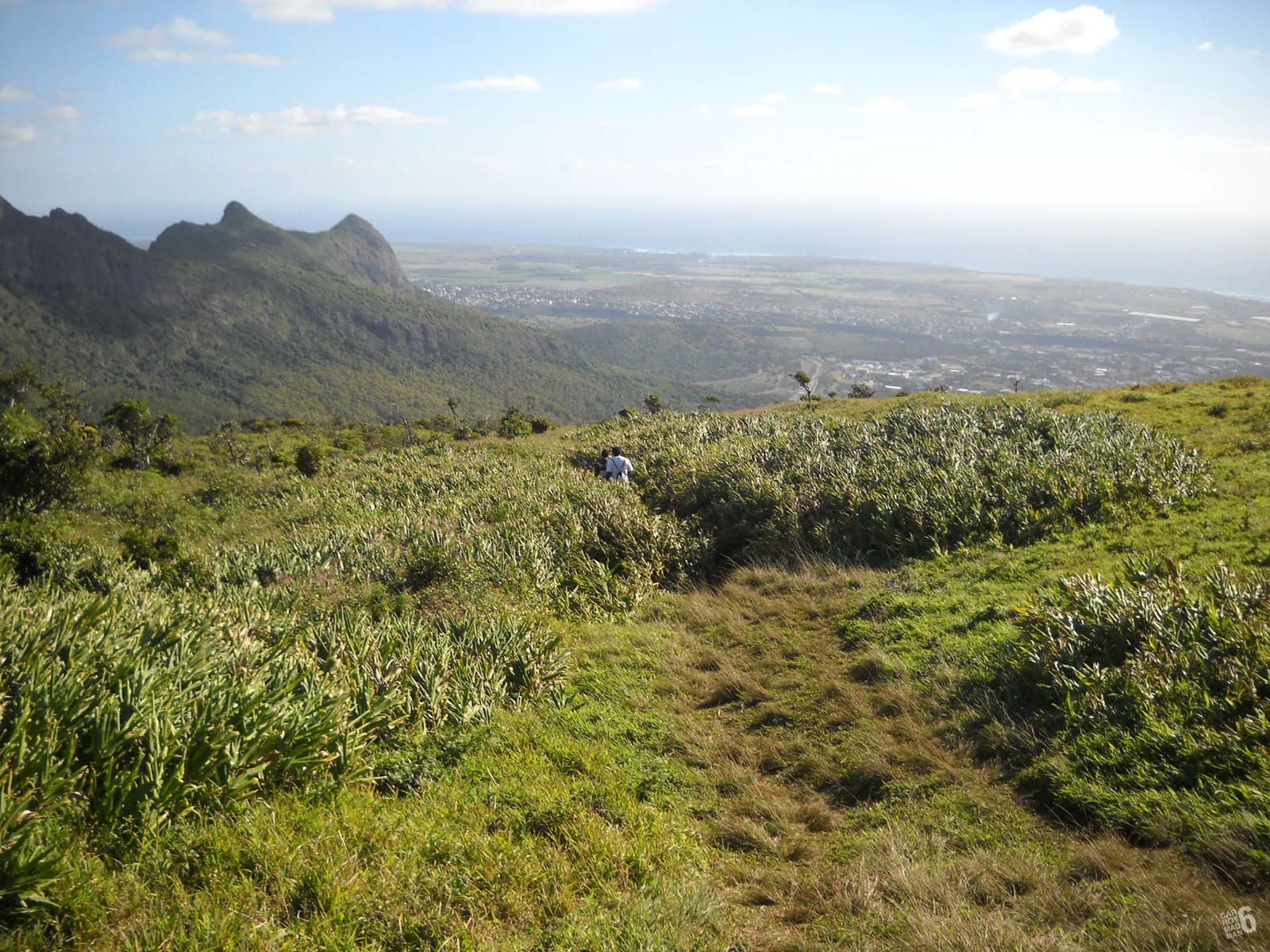
What the hike is like
From the car park above Saint-Pierre the route climbs in three moods. A farm track through cane leads to a kiosk, a forest path switchbacks up to a grassy shoulder at about 620 to 630 m, and the thumb rises from that shoulder in one steep, narrow push to the top. Most of the height is gained in the forest, where the going is rooty and sometimes muddy but never difficult.
The mapped track on this site measures 2.05 km from the car park at 381 m to the summit, with about 390 m of ascent, so roughly 4 km for the round trip. Published figures range from 3.7 to 4.6 km and from 320 to 410 m of climbing, which comes down to where each walker started recording and how far they wandered on the shoulder. Whatever the exact number, it is the character of the last section, not the distance, that decides whether you enjoy it.
Our honest view is that Le Pouce is often called easy, and that the word misleads beginners. Most of the route is approachable for anyone who walks regularly. The summit finish is steeper, narrower and more exposed than the approach, and you can stop below it on the shoulder and still have an excellent view.
The route from Petit Verger, stage by stage
The stages below follow the mapped track, which you can trace on the map and elevation profile in this section. Distances and heights are approximate and come from the GPS recordings and guides cited at the end of the page.
The car park above Saint-Pierre, about 381 m
The walk starts at a small car park at the end of a farm road above Saint-Pierre, at about 381 m. A wooden sign lists the routes that leave from here, including the classic Le Pouce path and the crossing to Le Dauguet. Take the wide farm track beyond the cars, with cane on both sides and the thumb already in view above you.
The farm road and the kiosk junction
After roughly half a kilometre of gentle climbing the track reaches a large kiosk and a junction at about 437 m. The waymarked summit path leaves the farm road here, and the blue and white paint on posts and trees is your guide from now on. If you are still on a wide vehicle track through cane several minutes later, you have missed the turn.
Forest switchbacks and rock cuts
Above the kiosk the path narrows and climbs through secondary forest of guava, acacia and palms in a series of switchbacks, with a few short rock cuts where the trail has been worked into the slope. The ground is rooty and rocky, slippery after rain, and a small rock shrine marks one bend. This is the sustained part of the ascent, roughly 190 m of height gain in about 700 m of path, and the only real effort most hikers feel.
The grassy shoulder at about 620 to 630 m
The forest opens onto a grassy shoulder, sometimes called the plateau or the Esplanade, at roughly 620 to 630 m. Most people reach it in under an hour. The thumb stands directly above, Pieter Both’s balanced rock shows to the east, Port Louis appears to the north-west, and the path from Tranquebar comes up from the far side to join the route here. Rest here, decide about the final climb, and turn back if the top is in cloud or the wind is strong.
The trench and the rock step on the thumb
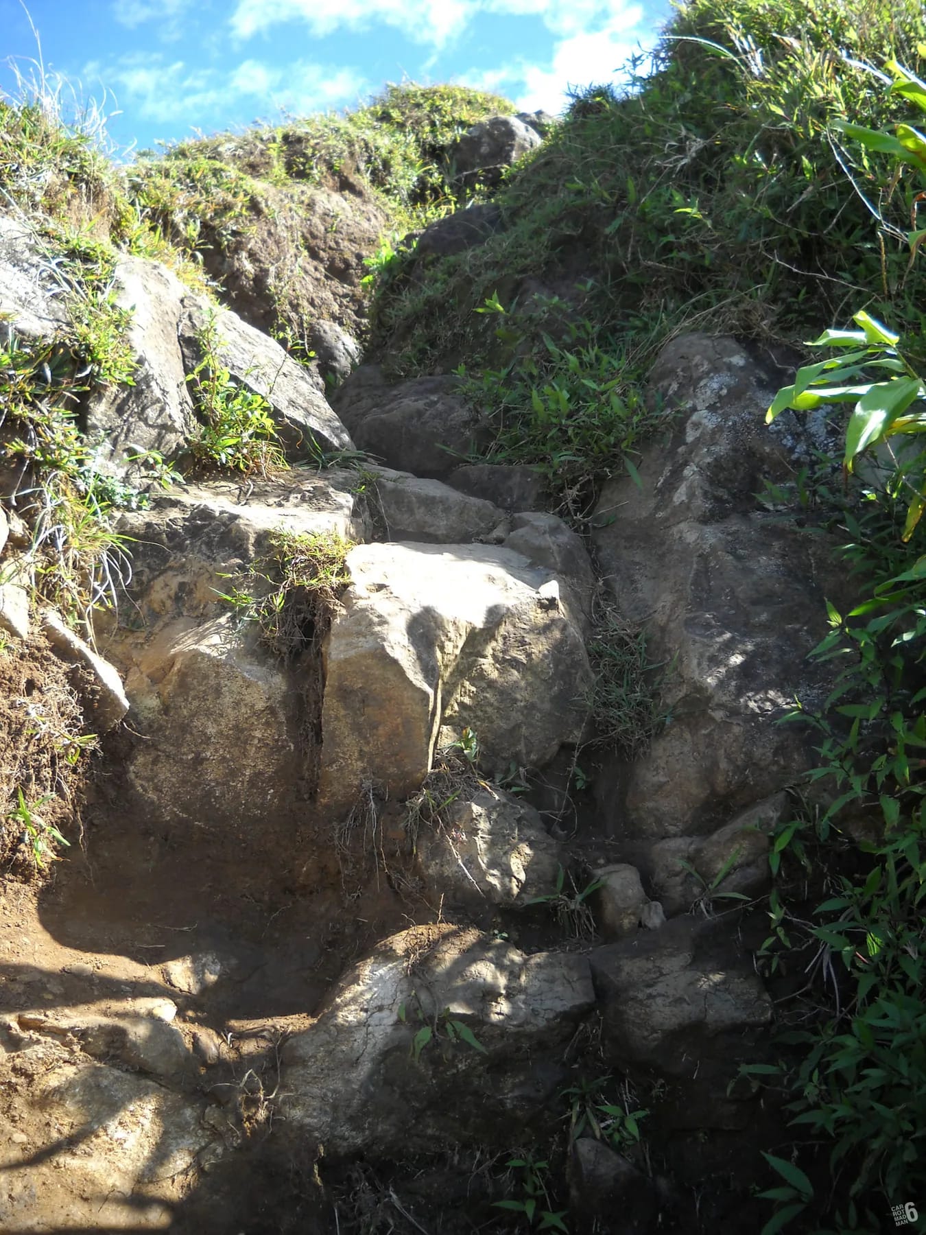
From the shoulder the route turns onto the thumb itself and changes character. The path becomes a narrow trench worn into the ridge, with rock on both sides for about 30 m, then a short rock step where you will want a hand or two for a few metres. The final hundred metres are steep, the holds are polished by years of boots, and there is open air to one side in places. In dry, calm weather it is a short scramble that most reasonably agile adults manage. In wind, cloud or rain the honest advice is to stop at the shoulder.
The summit at 812 m
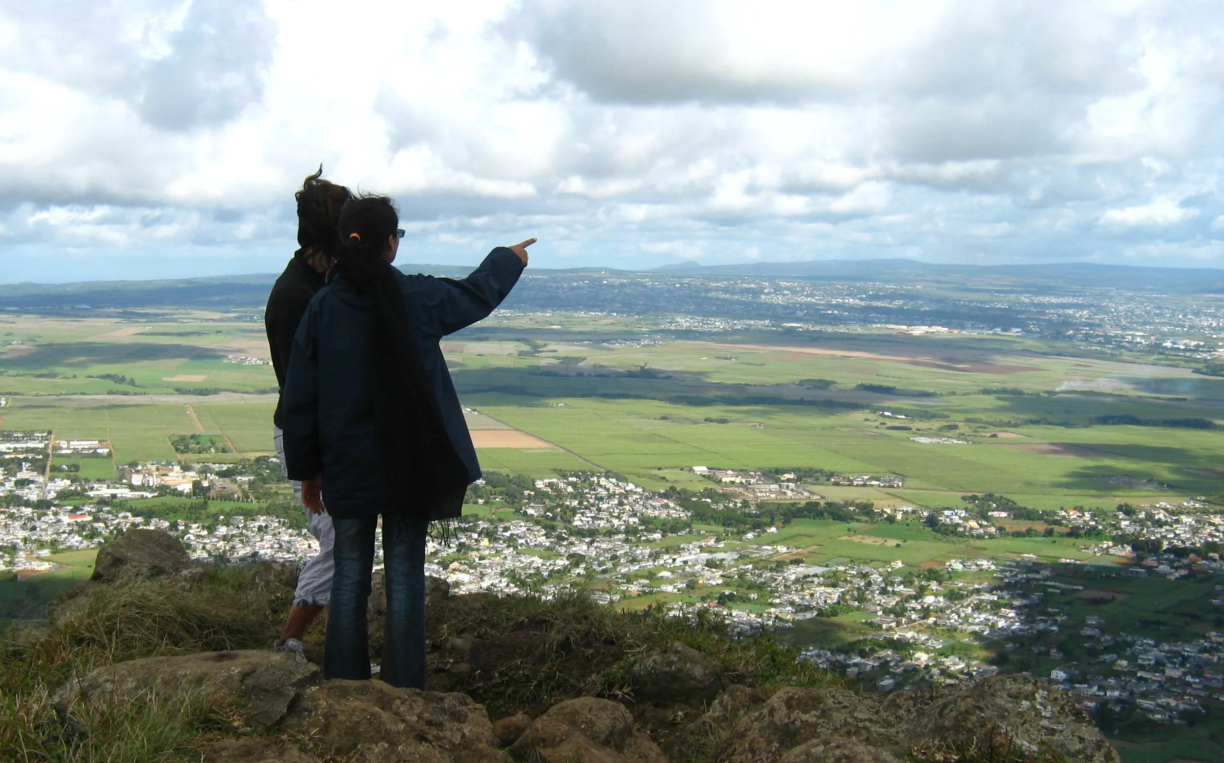
The top is a small rock platform at 812 m with room for perhaps six people to sit comfortably. On a clear day the view takes in Port Louis and its harbour, the northern plain running out to Coin de Mire and Île Plate, Pieter Both close by to the east, Berthelot Peak to the south and the plateau towns beyond. Sit down rather than stand, keep bags tidy and leave room for the next group.
The descent
Return the same way. The rock step and the trench are harder going down than up, because you cannot see your feet as well, so face into the rock where it helps and take your time. Below the shoulder the switchbacks are quick but slippery when wet, and a hiker who sprained an ankle on this descent in August 2026 had to be carried down on a stretcher by a police unit. Allow about an hour from the summit to the car.
Elevation profile from a 30 m terrain model, which smooths sharp summits. Distances follow the mapped path. Official summit height shown separately.
The summit finish, honestly
Guides and hikers describe the final part in strikingly similar terms. One calls the rock step a hand or two over a few metres, another describes the last 30 m as a trench along the ridge and advises anyone with vertigo to abstain, and a third talks about scrambling over rocky ledges and catwalks with significant exposure. They are all describing the same short section, and all of them are right.
In practice you will use your hands, the path is too narrow in places for two people to pass easily, and there is open air to one side where you would not want to slip. None of it is technical climbing and no rope is needed. It is, however, the one part of the mountain where wet rock, a gust of wind or low cloud changes the outing. A local newspaper report on a school ascent said the same, with the last 50 m relatively steep, care needed in wind or after heavy rain, and everyone seated on the small summit.
How long it takes and when to start
The times people record vary more than the distances. Fast walkers on Komoot log about 1 hour 45 for the loop, a Visorando recording from the Moka side gives 2 hours 10, and the most common guidance is 2 to 3 hours for the round trip. Three to four hours is realistic if you stop for photographs on the shoulder, wait your turn on the summit and take the descent slowly. Most people reach the shoulder in under an hour.
Start early. The lower track through the cane is open to the sun, the summit is at its clearest before cloud builds in the late morning, and the car park fills at weekends. Mauritius has no daylight saving and dusk is short, around twenty minutes. If you set off in the afternoon, work back from sunset, which is as early as 17:38 in June, and carry a head torch as a matter of course.
| Source | Distance | Ascent | Time |
|---|---|---|---|
| Mapped track on this site | 2.05 km one way | About 390 m | Not timed |
| Komoot highlight, more than 900 users | 4.18 km loop | 350 m | 1 h 45 |
| Visorando recording from the Moka side | 3.70 km loop | 402 m | 2 h 10 |
Water, shoes and what to carry
There is no water on the route and no shop at the car park. Carry at least 1.5 litres per person, more in summer, and drink on the shoulder before the final climb, where you will want your hands free. The surface is a mix of polished basalt, roots and red mud, and ordinary trainers struggle on it after rain.
- Shoes with real grip. Trail shoes or light boots are ideal, and smooth-soled trainers slide on the wet rock of the final step.
- A hat and sunscreen for the open cane track, and a light windproof layer for the summit, which is breezy on most days.
- A head torch if there is any chance of finishing near dusk, and a charged phone with the route downloaded, because mobile coverage is decent on the ridges but not guaranteed.
Following the blue and white waymarks
The route is marked with blue and white paint on posts and trees, and one local guide counts about fifteen signposts between the car park and the top. The marking is good, but pay attention at junctions, and the kiosk is the first. On the forest switchbacks, a useful rule from one visitor is to keep the summit on your left at any fork.
The junction that matters most is on the shoulder, where the path from Tranquebar and Port Louis arrives from the north-west. Going up, the thumb is obvious. Coming down, take the path that drops back into the forest towards Saint-Pierre rather than the one heading over the far side, which would leave you in Port Louis a very long way from your car. Download the route from the map page so that your phone can settle any doubt.
Sharing a very small summit
The top of Le Pouce seats about six people comfortably and feels crowded above ten, and the mountain is climbed every day of the week. On a weekend morning you may wait on the last few metres while a group ahead finishes its photographs. Sit rather than stand, keep bags against the rock and move on once you have had your look, so that the people behind you get theirs. Ten or fifteen minutes on top is the polite rhythm.
The view, when the cap of cloud lifts, is the one Charles Darwin admired in May 1836, when he wrote that the country on this side looked well cultivated, divided into fields and dotted with farmhouses. The summit view page describes it in detail.
Questions people ask
How long is the Le Pouce hike?
On the mapped track it is about 2 km from the Petit Verger car park to the summit, so roughly 4 km for the round trip, with about 390 m of ascent. Published GPS recordings range from 3.7 to 4.6 km depending on where people started and how far they wandered on the shoulder. Most hikers take 2 to 3 hours, and 3 to 4 with photographs and a rest on top.
Is Le Pouce easy to climb?
Most of it is. The farm track, the forest switchbacks and the grassy shoulder are an easy to moderate walk for anyone who exercises regularly, and children of 8 to 10 who are used to walking manage them. The final hundred metres on the thumb are steep, narrow and exposed, with a rock step that needs hands. That part is not easy, and it is fine to stop below it.
Do you need a guide for Le Pouce?
No. There is no fee, no permit and no requirement for a guide, and the route is waymarked in blue and white. A guide is useful if you want local knowledge, a lift from your hotel or company on the summit scramble, but confident walkers with the route downloaded manage alone. Pieter Both next door is the mountain that needs ropes and a guide.
Is there water on the trail?
No. Nothing we found mentions any water source on either route, and there is no shop or kiosk selling anything at the Petit Verger car park. Carry at least 1.5 litres per person and more in the summer months from November to April, when the open track through the cane is hot by mid-morning.
Where does the hike start?
At a small car park at the end of a farm road through the cane above Saint-Pierre, at about 381 m. It is reached from the B47 between Moka and Saint-Pierre at a sharp bend after the mosque, where a small brown Le Pouce sign points up the farm road. GPS is roughly -20.2076, 57.5270. The trailhead page has turn-by-turn directions and bus options.
Can you climb Le Pouce from Port Louis instead?
Yes. A longer northern route starts in Tranquebar where Chateau d’Eau Street ends, passes Le Dauguet and climbs about 690 m over 3.6 km to join the Petit Verger route on the shoulder below the summit. It is shadier and more gradual but roughly twice the climbing and twice the time. Buses at both ends make a through-hike possible.
Find the start
The trailhead page gives turn-by-turn directions to the Petit Verger car park, parking notes and the buses to Saint-Pierre.