
Le Pouce trail map and GPX files
This page holds the map. Both documented routes up Le Pouce are drawn on it, the short climb from Petit Verger on the Moka side and the long one from Tranquebar in Port Louis, with their elevation profiles and the junction on the shoulder where they meet. You can download each route as a GPX file for your phone. Read the notes on what the files are made of before you trust them on the summit.
Read the guide
The two routes on one map
The map shows the mapped geometry of both routes from OpenStreetMap, with the elevation profile drawn from a terrain model. The Petit Verger route starts at the car park at 381 m and reaches the summit in 2.05 km with about 390 m of ascent. The Port Louis route starts at about 88 m where Chateau d’Eau Street ends in Tranquebar and reaches the same point in 3.6 km with about 690 m of ascent. They join on the grassy shoulder below the thumb and share the final climb.
Use the map to understand the shape of the day rather than to navigate metre by metre. The real path is marked on the ground in blue and white, and the places where the map matters most are the two junctions, at the kiosk on the Petit Verger side and on the shoulder, where a wrong turn on the descent sends you down the other side of the mountain and a long way from your car.
Elevation profile from a 30 m terrain model, which smooths sharp summits. Distances follow the mapped path. Official summit height shown separately.
The Petit Verger route in numbers
The southern route is short and its profile is simple. A gentle half kilometre of farm track leads to the kiosk, the forest switchbacks climb hard for about 700 m of path, the shoulder gives a flat breather and the thumb finishes steeply. The Hiking Project recording puts the average grade at 16 percent and the steepest at 35 percent. The waypoints below come from a Visorando recording of the same route, which matches the mapped track closely.
| Point | Distance from the car park | Altitude |
|---|---|---|
| Car park, Petit Verger | 0 km | 381 m |
| Kiosk and junction | About 0.5 km | About 437 m |
| Grassy shoulder, junction with the Port Louis path | About 1.2 km | About 625 m |
| Summit | 2.05 km | 812 m |
The Port Louis route in numbers
The northern route gains nearly twice the height over nearly twice the distance, and its profile is lopsided. The first part through Le Dauguet and the woods climbs gently, then a signboard marks the turn where the path steepens, and most of the ascent is packed into the final 2 km. The waypoints below are from a Visorando loop that starts at the Champ de Mars racecourse, about a kilometre before Le Dauguet, so the distances are longer than those on the direct mapped path from the street end.
The recording covers about 6 km between Le Dauguet and the summit against 3.6 km on the direct mapped path, so it clearly follows a longer line through the nature trail and the woods. The Explore Mauritius description, at 6.3 km one way, does the same. Both are real ways up. The painted stones follow the main path, and the altitudes are the figures to trust.
| Point | Distance from the racecourse | Altitude |
|---|---|---|
| Le Dauguet sports area and oratory | About 1 km | 66 m |
| Hindu temple, with monkeys | About 2.6 km | 198 m |
| Signposted junction where the path steepens | About 4.7 km | 271 m |
| Clearing above Port Louis | About 6.9 km | 729 m |
| Summit | About 7.1 km | 812 m |
The GPX files and what they are made of
Two GPX files are available, one per route. Both are built from OpenStreetMap path geometry, which is drawn by volunteers from GPS traces and aerial imagery and is accurate to a few metres on open ground and less under trees. The elevation in each file comes from a terrain model with a 30 m grid, not from a barometric recording on the mountain. That matters on Le Pouce, because a 30 m grid cannot resolve a thumb of rock a few metres across. The model smooths the summit to about 756 m, while the mapped peak and every survey give 812 m.
The practical consequence is that the elevation profile understates the final climb by roughly 50 m and makes the thumb look gentler than it is. The distance and the shape of the route are reliable. The last hundred metres are steeper than the profile suggests, which is why this site describes them in words as well as in a line on a chart.
- Petit Verger route, 2.05 km, about 390 m of ascent, download at /downloads/le-pouce-petit-verger.gpx.
- Port Louis route, 3.6 km, about 690 m of ascent, download at /downloads/le-pouce-port-louis.gpx.
- Both files end at the mapped summit point, 812 m on OpenStreetMap, even though their profiles top out at 756 m.
Loading a GPX file on your phone
A GPX file is a plain list of coordinates that most walking and mapping apps can open and draw over a base map. Download the file at home or at your hotel over wifi, open it in your chosen app and, crucially, download the map tiles for the Moka area for offline use. Coverage is described as decent on the ridges, but you cannot rely on it under the trees of the Port Louis side, and a phone that has to stream its map is a phone that runs out of battery at the wrong moment.
Start the day with a full charge, keep the screen off between junctions and treat the phone as a way to settle doubts rather than as a guide to follow step by step. On the thumb put it away completely. You need both hands, and the trench is no place to be looking at a screen.
What the waymarks look like on the ground
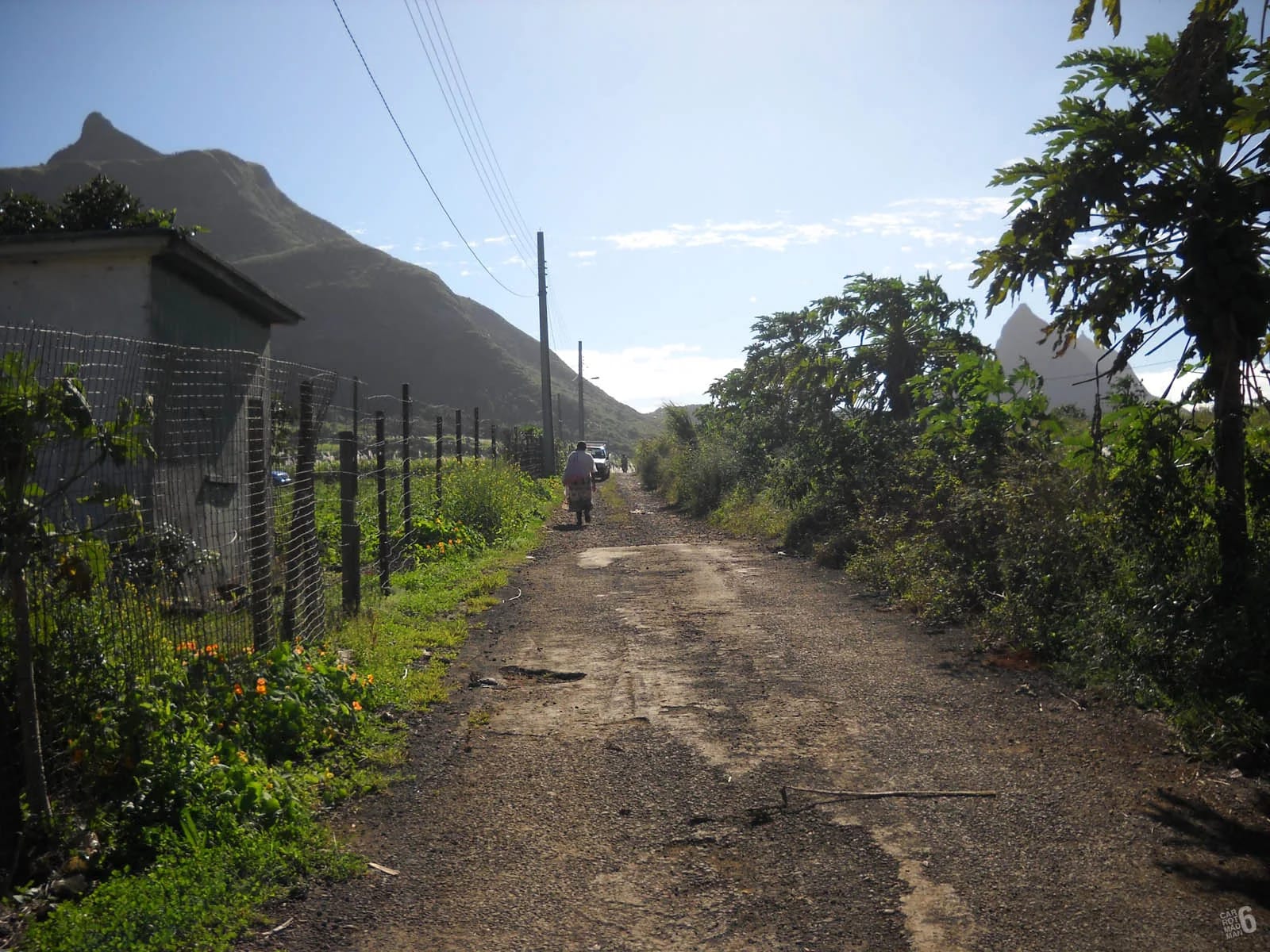
From Petit Verger the route is marked with blue and white paint on posts and tree trunks, and one local walking guide counts about fifteen signposts between the car park and the summit. OpenStreetMap rates the track’s visibility as excellent. From Tranquebar the marks are blue and white painted stones every few hundred metres, with a signboard at the point where the trail turns left and steepens. Both sets of marks are maintained informally, and a fallen post or a faded stone is normal rather than a sign that you are lost.
Two rules cover most of the doubt. In the forest below the shoulder, keep the summit on your left at any fork. On the shoulder, remember which side you came up, because the two routes leave it in opposite directions and both are well trodden. The health track at the Petit Verger entrance is watched by Safe City cameras, which has nothing to do with navigation but reassures some walkers about the car.
Other maps and recordings
Several community recordings of the mountain exist, and comparing them is instructive. The Komoot highlight for the Petit Verger loop has been walked by more than 900 users and measures 4.18 km. Visorando has recordings from both sides. The Hiking Project describes the southern route as a 4.6 km out and back and gives the gradients. Atlas & Boots measured 4.3 km. None of them agree exactly, because each starts and stops in a slightly different place and consumer GPS wanders under trees and on a sharp summit. The spread is normal. The mountain is the same.
Wikipedia and OpenStreetMap both give 812 m for the summit, and this site uses that figure throughout. You may see 811 m in tour listings and 820 m in older references. None of that changes the route, and none of it changes the fact that the last hundred metres are the ones to respect.
Questions people ask
Is there a map of the Le Pouce trail?
Yes, on this page. It draws both documented routes, from Petit Verger on the Moka side and from Tranquebar in Port Louis, with an elevation profile for each and the junction on the shoulder where they meet. The geometry comes from OpenStreetMap and the elevation from a terrain model, so use it for planning and for settling doubts at junctions rather than for metre-by-metre navigation.
Can I download a GPX file for Le Pouce?
Yes. There is one file for each route, at /downloads/le-pouce-petit-verger.gpx and /downloads/le-pouce-port-louis.gpx. Download them over wifi before you travel, open them in any walking app that reads GPX, and save the map tiles for the Moka area offline. Coverage on the mountain is decent on the ridges but not under the trees, and the phone is a backup, not a guide.
Why does the elevation profile stop at 756 m?
Because the heights in the GPX files come from a terrain model with a 30 m grid, which cannot resolve a narrow rock thumb and smooths the summit down to about 756 m. The real summit is 812 m on OpenStreetMap, Wikipedia and every survey. The profile therefore understates the final climb by roughly 50 m. The distances and the shape of the route are not affected.
Do I need GPS to climb Le Pouce?
Not in good weather on the Petit Verger route, which is waymarked in blue and white with about fifteen signposts and a clear path. It becomes useful at the kiosk junction, on the shoulder where the two routes separate, and on the Port Louis side where the woods and the nature trail offer several lines. Download the route anyway. It weighs nothing and settles arguments.
Is the Le Pouce trail marked?
Yes, informally but well. From Petit Verger there is blue and white paint on posts and trees, and from Tranquebar blue and white painted stones every few hundred metres with a signboard at the steep turn. Marks fade and posts fall, so expect gaps. Keep the summit on your left at forks in the forest, and on the shoulder remember which side you climbed from.
Which route does the map recommend?
Petit Verger for most people. It is 2.05 km with about 390 m of ascent and takes 2 to 3 hours return. The Port Louis route is 3.6 km with about 690 m of ascent, shadier and more gradual but a 5 to 6 hour day. The profiles make the difference obvious. Both finish with the same steep hundred metres on the thumb, which no map can soften.
Read the route in words
The hike page describes each stage of the Petit Verger route, with the honest word on the trench and the rock step that the profile cannot show.