
The Moka Range
The Moka Range is the broken ring of old volcanic mountains that curves around Port Louis on the landward side. It runs for about 20 km, holds the second and third highest summits on the island, and its highest ground above the capital is protected watershed and cloud forest. Le Pouce is its best-known walk, but it is only one tooth in a long jaw.
Read the guide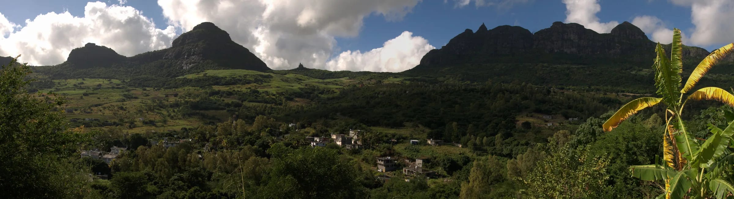
A semicircle of old mountains around the capital
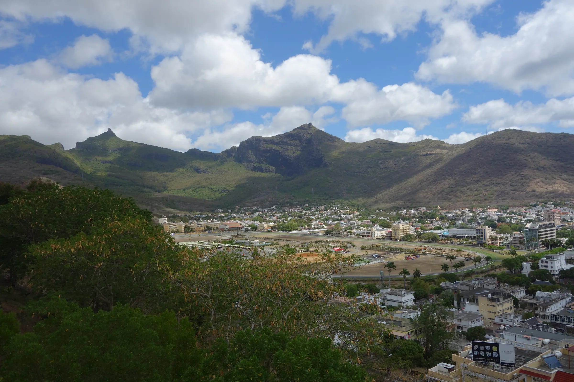
Stand on the Champ de Mars in Port Louis and turn your back to the sea. Everything in front of you is the Moka Range. It curves around the city from Pieter Both and the Vallée des Prêtres in the east round to Snail Rock, which hikers reach from the Signal Mountain side above the south of the city, a semicircle of sharp, weathered peaks that gives Port Louis its amphitheatre setting. Guidebooks put its length at about 20 km. The Key Biodiversity Area factsheet that covers it describes a main ridge running east to west with three spurs pushing northward, rising from 20 m at the edge of the plain to 823 m at Pieter Both.
Charles Darwin, who climbed Le Pouce in May 1836, described the centre of the island as a great platform ringed by old, broken basaltic mountains whose strata dip towards the sea. That is still the clearest one-sentence description of the range. It is the eroded rim of the island’s oldest volcanic shield, not a single volcano, and the peaks are what survived when the softer rock between them was carried off by rivers and rain.
How old is open to argument. The Wikipedia entry for the range says it formed from a basalt lava dome about ten million years ago. The geological literature instead places the island’s Older Series basalts between roughly 9.0 and 4.7 million years ago, with one study narrowing that to 7.8 to 5.4 million years and dating a trachyte plug associated with those basalts to about 6.85 million years. The honest summary is that these mountains are several million years old and belong to the first phase of the island’s growth. The geology page on this site goes into the rock itself.
The peaks, from Pieter Both to La Fenêtre
Two of the three highest summits in Mauritius stand in this range, less than three kilometres apart. Pieter Both, with its balanced boulder, is 820 m on most maps and 823 m in the biodiversity factsheet. Le Pouce is 812 m, although Wikipedia’s own geography page gives it 820 m and some tour listings say 811 m. This site uses 812 m, the figure in the Le Pouce entry, the factsheet and the OpenStreetMap survey. Montagne Ory, at about 700 m, is the next peak the factsheet names.
Around Le Pouce the crest carries a set of lesser summits that are mapped but rarely written about. OpenStreetMap records Guiby Peak at 670 m and Snail Rock at 620 m, north-west of the thumb, and names Berthelot Peak, Grand Peak, Grand Glacis, Crève Coeur and La Fenêtre along the same line without published heights. From the Le Pouce trail you see Snail Rock and the city as the path wraps around the thumb, and Berthelot Peak stands out to the south. Grand Peak matters to botanists because it is one of only four known sites for Nesocodon, a plant genus of a single species found nowhere outside Mauritius.
| Peak | Height | Notes |
|---|---|---|
| Pieter Both | 820 m (823 m in the KBA factsheet) | Second-highest on the island. Roped climb to the summit boulder, first climbed in 1832. |
| Le Pouce | 812 m | Third-highest. Walked from Petit Verger or Port Louis, with a short steep finish. |
| Montagne Ory | About 700 m | Named in the KBA factsheet. No visitor route in the sources used. |
| Guiby Peak | 670 m | Mapped on OpenStreetMap as a neighbour of Le Pouce. |
| Snail Rock | 620 m | Seen from the Le Pouce trail. Reached from the Signal Mountain side. One account says the approach from Le Pouce needs climbing gear. |
| Berthelot Peak | Not published | Prominent to the south of the Le Pouce trail. |
| Grand Peak and La Fenêtre | Not published | Mapped names on the crest. Grand Peak is a site for the endemic Nesocodon. |
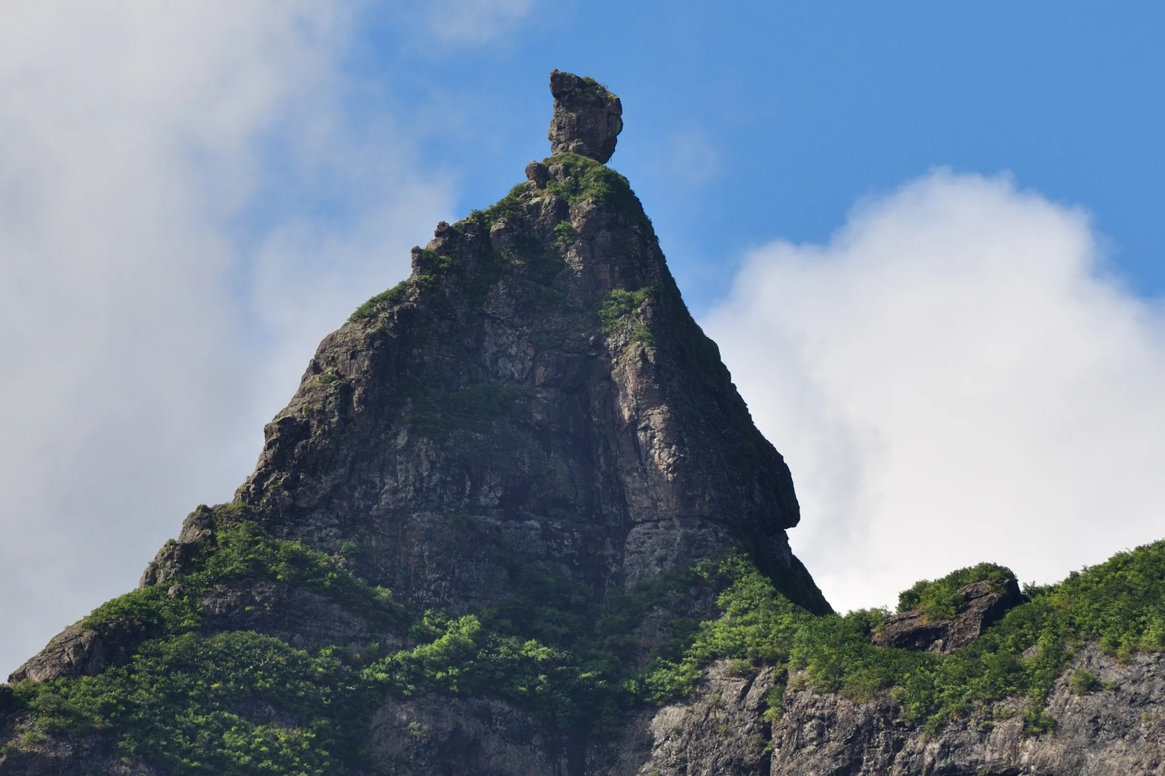
The ridge between Le Pouce and Pieter Both
The two giants are close neighbours. PeakVisor gives the distance from Le Pouce to its nearest higher neighbour, Pieter Both, as 1.7 miles, roughly 2.7 km, to the east-north-east. From the meadow below the Le Pouce summit the balanced rock is in plain view, and it is natural to wonder whether you can simply walk the ridge from one to the other.
The honest answer is that no published route description exists. None of the hiking databases, guidebooks or local press reports used for this site describe a marked path along the crest, and the Le Pouce waymarks end at the thumb. The ground between the two is known to local trail runners rather than visitors. The Moka Trail event uses it, with a 15 km race called Petit Both that climbs 800 m to the col between Le Pouce and Pieter Both before returning, and a 30 km Grand Pouce with 1,500 m of climbing. If you want to see that country, run with them or go with someone who knows it. Do not improvise a traverse on the strength of a map alone.
The reserves that protect the water above Port Louis
The highest ground of the range is doing a job as well as making a view. The Moka Mountain Reserves protect the watershed above Port Louis and Notre-Dame, and Le Pouce Nature Reserve, created in 1951, covers 0.69 km² of the thumb’s north-western flank. The KBA factsheet calls Le Pouce’s cloud forest the only significant stand of native vegetation left in the whole range. It holds several critically endangered plants, and other endemics are known from single sites elsewhere in the Moka mountains.
That is a small island of native forest in a sea of other things. The factsheet lists exotic scrub, grassland and eucalyptus plantations as the dominant cover, and hunting, conservation, tourism and water as the land uses. When it was assessed in 2001, only 0.49 per cent of the 79.59 km² Key Biodiversity Area had formal protection. Rainfall over most of the range is 1,000 to 2,000 mm a year, drier than the forests of the south-west and east, which is why the native vegetation clings to the summits where cloud adds moisture the rain does not.
The Mauritius kestrel was reintroduced to the range in the early 1990s, mainly in the Anse Courtois valley, and was expected to spread along it. The Mascarene swiftlet is present. Legally, the reserves fall under the Forests and Reserves Act of 1983, which lets an authorised officer restrict access to any nature reserve. No closure of Le Pouce was found in the record from 2023 to 2026, but the power exists.
Where to see the whole range
From inside Port Louis you are too close, and the buildings hide the lower slopes. The classic view is from the north. Darwin saw it on arrival across the sloping plain of Pamplemousses and remembered peaks jagged into the sharpest points. Any high point on that plain, or the road in from the north coast, shows the range as a wall with Pieter Both’s head and the thumb of Le Pouce as its two unmistakable marks.
Inside the city, climb to the Citadel. Fort Adelaide, built between 1834 and 1840 on the hill above the Champ de Mars, looks straight across at the mountains with the racecourse in the foreground, and it is the easiest place to understand how completely they enclose the capital. From the harbour and the Caudan waterfront the view is reversed, with the thumb rising directly behind the town, which is the angle most old prints and most modern photographs use.
The best view of all is from the range itself. The summit of Le Pouce looks along the crest to Pieter Both in one direction and down to Snail Rock and the city in the other, and from the meadow below the summit you can follow the curve of the mountains from the Vallée des Prêtres round towards the south.
How the range shapes a visit to Le Pouce
The range has a quiet side and a city side, and Le Pouce can be climbed from both. The Moka side, from Petit Verger above Saint-Pierre, starts high at 381 m and gives the short, standard walk of 2.05 km and about 390 m of ascent. The Port Louis side, from Tranquebar and the Le Dauguet trail, starts at about 88 m and climbs nearly 700 m through the reserve, with more shade and far fewer people. Buses serve both ends, which makes a crossing from the capital to Moka a practical day.
Because the summits gather cloud, a clear range from the Pamplemousses plain in the morning does not promise a clear summit two hours later. Check the forecast for the centre of the island rather than the coast, go early, and treat the lesser peaks as things to look at rather than things to climb unless you have local company. The pages on the geology, the nature reserve and the view from the summit pick up where this one stops.
Questions people ask
Which is the highest peak in the Moka Range?
Pieter Both, at 820 m on most maps and 823 m in the Key Biodiversity Area factsheet. Le Pouce follows at 812 m, then Montagne Ory at about 700 m. Only Piton de la Petite Rivière Noire in the south-west, at 828 m, stands higher anywhere on the island, so the range holds two of the three highest summits in Mauritius.
How long is the Moka Range?
About 20 km, the figure used by most guidebooks. The Key Biodiversity Area that follows the range covers 79.59 km² and describes a main east to west ridge with three northward spurs, rising from 20 m where the mountains meet the plain to 823 m at Pieter Both.
Is Le Pouce part of the Moka Range?
Yes. Le Pouce is the range’s second-highest peak and the one that stands closest above Port Louis. The thumb-shaped summit block is what makes it easy to pick out from anywhere in the north of the island, and the standard walk up it starts from the Moka side at Petit Verger.
Can you hike along the ridge from Le Pouce to Pieter Both?
There is no published route and no waymarking beyond the Le Pouce summit. The Moka Trail races use the col between the two, so the ground is known to local runners, but visitors should treat the two mountains as separate outings. Pieter Both’s summit needs ropes and a guide however you reach its base.
What is the Moka Mountains Key Biodiversity Area?
An internationally recognised site of 79.59 km² covering the range, assessed in 2001 for its endemic plants and birds. Le Pouce’s cloud forest is the only significant native vegetation it contains. Exotic scrub, grassland and eucalyptus plantations cover most of the rest, and only a small fraction has formal protection as nature reserve.
Where is the best place to see the whole Moka Range?
From the north, on the Pamplemousses plain or the road in from the north coast, where the range stands as a wall with Pieter Both and Le Pouce as its landmarks. Inside Port Louis, the Citadel gives the best view over the racecourse to the mountains, and the summit of Le Pouce shows the crest from within.
Choose between the two big neighbours
Le Pouce is a walk and Pieter Both is a roped climb, and the comparison page explains who should pick which.