
Hiking in Mauritius, seen from the centre
Mauritius is a small volcanic island of 1,860 km² whose mountains are the worn rim of its oldest volcano, standing in broken ranges around a central plateau. None reaches 830 m, yet several are steep, exposed and serious. This page is the overview a visitor needs before choosing a hike, written from the centre of the island where Le Pouce stands above the capital.
Read the guide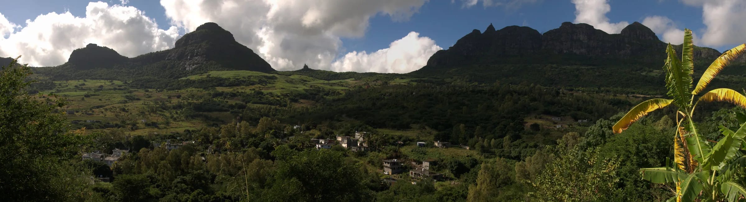
An island of old rims
The geography is simple once you have seen it from a summit. A narrow coastal plain rises to discontinuous mountains that encircle a central plateau, cooler than the coast and carrying up to twice its rainfall. The mountains are the remains of the island’s first volcanic shield, several million years old, left standing when the softer rock between them wore away. Darwin, who climbed Le Pouce in 1836, described the centre of the island as a great platform surrounded by old broken basaltic mountains with their strata dipping towards the sea.
Wikipedia groups the mountains into three main ranges, Black River in the south-west, Moka or Moka-Port Louis in the north and Grand Port-Savanne in the south-east. Some guides split the eastern and southern hills further and name the Bambous and Savanne ranges separately. PeakVisor counts 137 named mountains on the island, most of them modest. The peaks a visitor will hear about are perhaps a dozen, and the table below has the ones that matter.
The ranges and their mountains
The Moka Range curves around Port Louis for about 20 km and holds Pieter Both at 820 m and Le Pouce at 812 m, the second and third highest summits in Mauritius, with Montagne Ory at about 700 m and Snail Rock at 620 m along the same crest. The Black River range in the south-west holds the highest point, Piton de la Petite Rivière Noire at 828 m, inside the Black River Gorges National Park, which covers 67.54 km², was created on 15 June 1994 and offers about 60 km of trails from two information centres. The eastern ranges around Grand Port are lower. The Bambous Mountains run for roughly 12 km between Montagne Chat and Montagne Table à Perrot, reaching about 630 m at Montagne Bambou, with Lion Mountain at about 480 m as their outlier above the bay.
Several famous mountains stand alone. Le Morne Brabant, 556 m, is the monolith at the south-western tip inscribed by UNESCO in 2008. Corps de Garde rises above the plateau towns to 720 m on Wikipedia’s geography page and 740 m on PeakVisor. Trou aux Cerfs at Curepipe is not a mountain but a dormant crater about 605 m high, 300 to 350 m across and some 80 m deep, an easy viewpoint rather than a climb. Montagne Cocotte at 780 m and Tourelle de Tamarin at 563 m complete the short list that Wikipedia’s geography page gives.
| Mountain or trail | Height | Region | Character | Guide |
|---|---|---|---|---|
| Piton de la Petite Rivière Noire, Black River Peak | 828 m | South-west, Black River Gorges National Park | Forest trail across the plateau, about 9 km return, 3 to 4.5 hours | Not stated as required |
| Pieter Both | 820 m | Moka Range, north | Exposed ridge and roped summit boulder, about 4 hours | Required, with rope, harness and helmet |
| Le Pouce | 812 m | Moka Range, above Port Louis | Waymarked walk with a short steep finish, about 4 km return, 2 to 3 hours | Optional |
| Macchabée trail | Plateau | Black River Gorges National Park | Forest loop, 14 km, 4 to 5.5 hours | Not stated as required |
| Trou aux Cerfs | About 605 m | Curepipe, central plateau | Dormant crater and easy viewpoint | None |
| Le Morne Brabant | 556 m | South-western tip | Managed heritage trail, lower section open, upper section closed | Optional, registered guides |
| Lion Mountain | About 480 m | Grand Port, south-east | Short steep ridge, exposed rock steps onto the head, 3 to 4 hours | Optional |
| Tamarind Falls, Sept Cascades | Not a summit | Henrietta, west of the plateau | Canyon of waterfalls | Strongly advised |
Seasons and the weather that matters
The Mauritius Meteorological Services divide the year into a warm, wet summer from November to April, with a mean temperature of 24.7 °C, and a cooler winter from June to September at 20.4 °C. January and February days reach about 29 °C at the coast, and July and August nights fall to about 16 °C. The island’s mean rainfall is 2,010 mm a year and 67 per cent of it falls in summer. February and March are the wettest months, October the driest. The central plateau is cloudier than the coast, with roughly six hours of sunshine a day in summer and five in winter.
For hikers this means May to November. The air is cooler and clearer, the rock dries faster and the summits are less often under cloud. The cyclone season runs from 15 November to 30 April, extended to 15 May for Mauritius, and the warning window in the local forecasts covers 1 November to 15 May. In a cyclone warning, no mountain is worth it. Within any month, mornings are better than afternoons, because cloud and showers build over the high ground as the day warms. There is no daylight saving time. Sunrise ranges from about 05:22 in November to 06:45 in July, sunset from 17:38 in June to 18:55 in January, and dusk lasts about twenty minutes.
Guides, permits and rules in general
Most mountain paths in Mauritius have no permit, no fee and no gate. Le Pouce and Lion Mountain are climbed freely from a farm road and a village street. That freedom comes with informal marking, painted stones and the occasional post rather than a signed network, so download a route before you go and do not rely on shortcuts. Nature reserves are a separate matter. The Forests and Reserves Act of 1983 lists them and, since a 2003 amendment, lets an authorised officer restrict access to any of them, so a reserve that is open today can lawfully be closed tomorrow.
Three places work differently. Le Morne Brabant is managed by the Le Morne Heritage Trust Fund with a visitor window of 07:00 to 16:00, a latest start of 14:30, registered guides as an optional service and an upper section that is closed. Pieter Both’s summit requires a professional guide and climbing equipment. Black River Gorges National Park is run by the National Parks and Conservation Service, with marked trails such as Macchabée and Parakeet and two information centres. Private estates such as the Vallée de Ferney charge for entry to their trails. Tamarind Falls near Henrietta, a canyon of waterfalls, is a place where guides are strongly advised. Of the hikes on this page, only Pieter Both requires a guide for a summit.
Safety basics for a tropical mountain
The hazards are heat, wet rock and time. Start early, carry at least 1.5 litres of water per person and more in summer, wear a hat and shoes with real grip, and expect basalt to be slippery long after rain. Dusk is short, so be off any technical ground well before sunset and carry a head torch in case. Mobile coverage on the ridges is generally decent but not universal. There are no venomous snakes and no large predators in Mauritius. Mosquitoes are a nuisance on the shaded northern routes, and macaques, introduced four centuries ago, are common on Le Pouce and elsewhere, usually close but not pushy.
Personal security deserves a sentence. Walkers on the Port Louis approaches to Le Pouce were robbed in 2022 and again in 2025, and the quieter trailheads anywhere are places to leave nothing visible in a car. Go in company where you can. If something goes wrong, the police are on 999 or 112 and the SAMU ambulance service on 114. Rescues on Le Pouce have been carried out by police special units, with a helicopter in one case, but there is no standing mountain rescue team and nobody should set out assuming one.
- Check the forecast for the mountain’s own region. The south-east is wetter than the west, and the Moka summits gather their own cloud.
- Tell someone your route and your turnaround time, and keep to that time.
- Stop below any exposed finish in wind, rain or low cloud. The meadow below Le Pouce and Viewpoint 2 on Le Morne are complete objectives.
- Carry a charged phone, a downloaded route and a small first-aid kit. An ankle sprain on Le Pouce in 2026 ended with a stretcher carry by a police unit.
Where Le Pouce fits for a visitor in the north or the capital
If you are staying in Grand Baie or anywhere on the north coast, or in Port Louis itself, Le Pouce is your mountain. The Petit Verger car park is roughly 20 to 25 minutes by car from the capital and about 45 minutes from Grand Baie, estimates to confirm locally rather than trust, and the standard route is a half-day out and back of about 4 km with 390 m of ascent. From Port Louis you can also walk straight up from Tranquebar, 3.6 km one way with about 690 m of climb, and come down to Moka for the bus back. It is the third-highest point on the island, needs no guide, costs nothing and gives the view over the capital that no other summit has.
It also makes a fair measure for the rest. If the last spur of Le Pouce felt comfortable, Lion Mountain’s head will feel familiar and Le Morne’s lower trail easy. If the meadow was as far as you wanted to go, the forest trails of the Black River Gorges will suit you better than any ridge, and Pieter Both can stay on the skyline where it looks best. The pages on this site cover the hike itself, the weather, safety and how to reach both trailheads by bus.
Questions people ask
Is there good hiking in Mauritius?
Yes, within limits. The island has no long-distance routes and no mountain above 830 m, but it has a dozen or so serious summits, a national park with about 60 km of trails and a World Heritage mountain. Most walks are half-day climbs with exposed finishes, best done early in the cooler months from May to November.
What are some easy hikes in Mauritius?
Le Pouce as far as the meadow below the summit, Le Morne Brabant’s lower trail to Viewpoint 2, the viewpoint at Trou aux Cerfs in Curepipe and the marked forest trails in the Black River Gorges National Park. Each has an obvious place to stop before anything steep or exposed, and none needs a guide.
How many mountains are there in Mauritius?
There is no official count. PeakVisor lists 137 named mountains, most of them low hills. The island has three main ranges, Moka, Black River and Grand Port-Savanne, and perhaps a dozen peaks that visitors will hear about, from Piton de la Petite Rivière Noire at 828 m down to Lion Mountain at about 480 m.
What are the famous mountains of Mauritius?
Le Morne Brabant for its history and World Heritage status, Pieter Both for its balanced boulder, Le Pouce for its thumb above Port Louis, Piton de la Petite Rivière Noire as the highest point, Lion Mountain for its crouching profile over Grand Port, and Trou aux Cerfs, a crater rather than a mountain, for the easy view from Curepipe.
How difficult is the Le Morne hike?
The open lower trail is graded 1 by the Trust Fund, about 2.5 km one way to Viewpoint 2 at 260 m, and takes most people two to three hours. The upper section, graded 3, is steep and loose rock in a gulley and is closed because of rockfall. Access runs 07:00 to 16:00 with a latest start of 14:30.
Do you need a guide to hike in Mauritius?
Not for most mountains. Le Pouce and Lion Mountain need none. Le Morne offers registered guides as an option. Pieter Both’s summit requires a professional guide with rope, harness and helmet, and guides are strongly advised at Tamarind Falls. Everywhere, informal marking means you should carry a downloaded route.
Start with the capital’s mountain
The Le Pouce hiking guide covers the standard route from Petit Verger stage by stage.